2021 West Coast Wildfires
Forums:
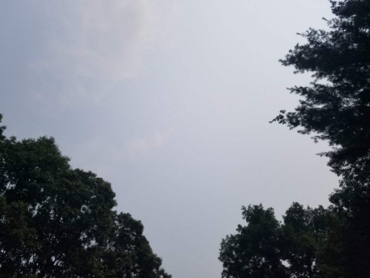
The smoke has finally reached the east coast. Nasty thick air today.
Todays sky.
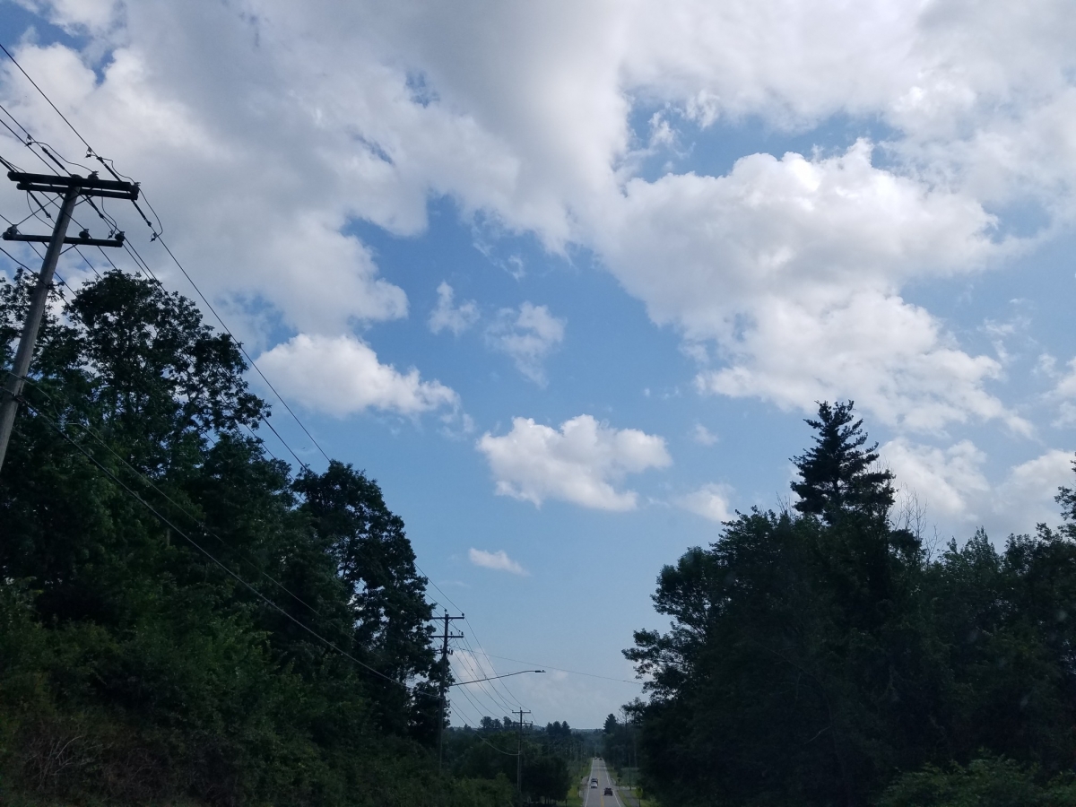
This is what it normally looks like.
Y'all using gas masks out west ?
- Log in to post comments
The smoke has finally reached the east coast. Nasty thick air today.
Todays sky.
This is what it normally looks like.
Y'all using gas masks out west ?
Top of Page Bottom of Page PermalinkFull Name: Philzone Refugee
No smoke in Seattle as yet,
No smoke in Seattle as yet, and hope it stays that way. After the bizarre 107 degree day we hit in June, things have calmed back down here. This week, the weather will be what we all love about Summer here, highs in the upper 70s with overnight lows in the mid 50s with a morning marine layer and sunny clear skies by noontime. The smoke season, which has only become a thing in the last 5 years, has usually arrived in early August. Fingers crossed it doesn't happen this year. I'm thinking about wearing a mask again, but at this point, not for smoke.
Top of Page Bottom of Page PermalinkFull Name: Ken D.
Thankfully for this town, the
Thankfully for this town, the smoke right now is blowing east.
The smoke and destruction from the fires in September was apocalyptic and has left us with a sort of collective PTSD when it comes to wildfires.
Top of Page Bottom of Page PermalinkFull Name: Def. High
In normal years the rain used
In normal years the rain used to return in August. before a drier early Fall.
Not holding my breath.
Top of Page Bottom of Page PermalinkFull Name: I rang a silent bell
I noticed the smokey haze
I noticed the smokey haze from those fires in Denver last week.
Top of Page Bottom of Page PermalinkFull Name: An organ grinder’s tune
yeah i mean not sure what to
yeah i mean not sure what to do at this point?
and water is becoming a larger issue by the minute...
there is no longer really an off-season for the hotshots and other personnel.
Top of Page Bottom of Page PermalinkFull Name: Rasputin O'Leary
All of earths water is fucked
All of earths water is fucked up. Tropical Opah fish washed up on a beach in Oregon recently,, but you still can't convince a repub there's climate change going on now. The variant taking em out may be our only Saving Grace (great Steve Miller song)
Top of Page Bottom of Page PermalinkFull Name: Druba
^
^
There's a large "hot spot" in the Ocean a thousand(s) miles off the Oregon coast, not suppose to be there, don't think i've ever seen one like this out there before. (Need a bunch of strong winter storms to punch it back to normal, but we haven't had that kind of zonal flow out there for a long time)
Meanwhile... (with now dated numbers)
Top of Page Bottom of Page PermalinkFull Name: _________
More Pics Of That Rad Opah.
More Pics Of That Rad Opah.
Top of Page Bottom of Page PermalinkFull Name: jazfish
I have also read somewhere
I have also read somewhere the Sahara Sands will be arriving in the US soon.
Top of Page Bottom of Page PermalinkFull Name: treat island
I read in today's newspaper
I read in today's newspaper that as of yesterday, the "Bootleg Fire" in southern Oregon had consumed 476 square miles, bigger than Los Angeles, 1/3 the size of Rhode Island, and other comparisons will be made. It's a huge fucking fire. The article was pointing out how vast the U.S. West is and that so much of it is wild. The fire won't be extinguished until months from now.
Top of Page Bottom of Page PermalinkFull Name: ...
>>>>There's a large "hot spot
>>>>There's a large "hot spot" in the Ocean
It's from Fukushima, that's what a lot of people are saying.
Top of Page Bottom of Page PermalinkFull Name: Def. High
Temperature anomaly from
Temperature anomaly from Fukushima not possible. A radiation "hot spot" from there is possible, however, although not likely.
Top of Page Bottom of Page PermalinkFull Name: Highnote
Yesterday the air was shite
Yesterday the air was shite on the Colorado front range. AQI was in the unhealthy range. 130 ish.
Top of Page Bottom of Page PermalinkFull Name: Sun so hot, clouds so low
We have smoke haze from the
We have smoke haze from the West coast here on the East coast for the last couple of days.
Top of Page Bottom of Page PermalinkFull Name: Lord Kalvert
I just postponed a road trip
I just postponed a road trip down to SF and other Norcal locations to visit friends next week. Was going to return over the Sierras and through Reno and the east side of the mountains on the way back- up to Klamath and quick stop at Crater Lake. A huge fire north west of Reno and the BOOTLEG has kiboshed plans for now.
https://www.youtube.com/watch?v=iPhqgl__XmQ
Top of Page Bottom of Page PermalinkFull Name: Mice elf
Top of Page Bottom of Page PermalinkFull Name: Druba
7/21/21 2:47 PM Fire Overview
7/21/21 2:47 PM Fire Overview
Source: NWCC(Northwest Interagency Coordination Center), InciWeb)
Oregon fires
* BOOTLEG (Location: 15 miles NW of Beatty, OR)
Acres: 395,463 - Cause: Lightning - Percent Contained: 32% - Estimated Containment Date: 2021-10-01
* BRULER (Location: 9 miles S of Detroit, OR)
Acres: 195 - Cause: Under Investigation - Percent Contained: 12% - Estimated Containment Date: 2021-09-30
* ELBOW CREEK (Location: 31 miles SE of Walla Walla, WA)
Acres: 18,590 - Cause: Under Investigation - Percent Contained: 20% - Estimated Containment Date: 2021-08-15
* GRANDVIEW (Location: 10 miles northeast of Sisters, OR)
Acres: 6,032 - Cause: Under Investigation - Percent Contained: 84% - Estimated Containment Date: 2021-07-23
* JACK (Location: 20 miles E of Glide, OR)
Acres: 18,993 - Cause: Under Investigation - Percent Contained: 55% - Estimated Containment Date: 2021-08-15
Washington fires
* CEDAR CREEK (Location: 4 miles WSW of Mazama, WA)
Acres: 14,857- Cause: Lightning - Percent Contained: 11% - Estimated Containment Date: 2021-10-31
* CHUWEAH CREEK (Location: Near and east of Nespelem, WA)
Acres: 36,407 - Cause: Lightning - Percent Contained: 40% - Estimated Containment Date: 2021-07-27
* CUB CREEK (Location: 5 miles N of Wintrop, WA)
Acres: 35,134 - Cause: Under Investigation - Percent Contained: 5% - Estimated Containment Date: 2021-08-31
* DELANCY (Location: 4 miles W of Mazama, WA)
Acres: 180 - Cause: Under Investigation - Percent Contained: 0% - Estimated Containment Date: 2021-10-31
* GODDARD ROAD (Location: 2 miles N of Rice, WA)
Acres: 724 - Cause: Under Investigation - Percent Containment: 25% - Estimated Containment Date: 2021-07-30
* GREEN RIDGE (Location: 30 miles E of Walla Walla, WA)
Acres: 3,248 - Cause: Lightning - Percent Contained: 15% - Estimated Containment Date: 2021-08-31
* LICK CREEK (Location: 2 miles SW of Asotin, WA)
Acres: 73,528- Cause: Lightning - Percent Contained: 45% - Estimated Containment Date: 2021-09-01
* RED APPLE (Location: Near/Adjacent to Wenatchee, Monitor, WA)
Acres: 12,288 - Cause: Under Investigation - Percent Contained: 94% - Estimated Containment Date: 2021-07-19
* SUMMIT TRAIL (Location: 17 miles W of Inchelium, WA)
Acres: 5,359 - Cause: Lightning - Percent Contained: 0% - Estimated Containment Date: 2021-07-31
Top of Page Bottom of Page PermalinkFull Name: Mice elf
And
And
GOD BLESS OUR FIREFIGHTERS
Top of Page Bottom of Page PermalinkFull Name: treat island
Oregon campfire ban East of I
Oregon campfire ban East of I-5 begins today. No fires, including in campsites, designated fire rings, pits, etc.
Top of Page Bottom of Page PermalinkFull Name: ParadiseWaits
Headache season is starting
Headache season is starting early this year for me.