Hall shares the Weminuche (thanks, Nedb)
Forums:
I'm not gonna lie, this turned out to be a challenging trip for me for a number of reasons:
Just 3 weeks prior to the trip I had strained my lower hamstring and upper calf which caused my knee to swell significantly (bursitis) so I had to basically do nothing and let it heal as much as it was going to heal which meant I went into the trek without so much as walking up and down the stairs with my pack on, much less the typical lead up training I would normally do.
And my pack was F'n heavy! Heavier than it has been for years. This was solo trip, so no sharing of items like stoves, filters, fuel, tents. Plus the weather in the San Juans had been pretty bad for the past month with heavy rain, hail and lightning in the region on a daily basis and temps at around freezing at night. So I carried a heavier, more robust (4 season) tent and sleeping bag, as well as extra layers. All that combined with 8 days of food made for a beast of a pack that, with the injury, had me considering blowing the whole thing off.
But I decided to push through, make the looong drive, and just take it hour by hour... I figured that since I would be within gimping distance back to the car for the first 2 days, I could always retreat if the knee got worse.
So I set off for Barstow after work on a Tuesday and endured 8 hours of stop and go traffic as well as a bunch of construction zones only to be bitten by some sort of bed bugs all night (at the F'n Holiday Inn Express near the In N Out Burger).
The next day was not much easier as I made the 11 hour dessert drive across Arizona to Durango, where I had some mediocre tacos at Nini's near my (thankfully bug free) hotel.
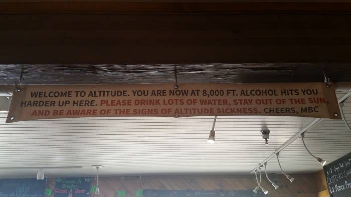
That night, final preparations kept me up 'til midnight, so the 5am wake up was kinda harsh, but I was able to get to the trailhead in time to drop my pack, drive 6 miles up to the exit trailhead, and then ride a beater bike (that I would lock to a tree) back to the trailhead just moments before a gnarly full blown thunder/lightning, rain/hail cell opened up right on top of me sending me scurrying for gore tex and cover until it passed.
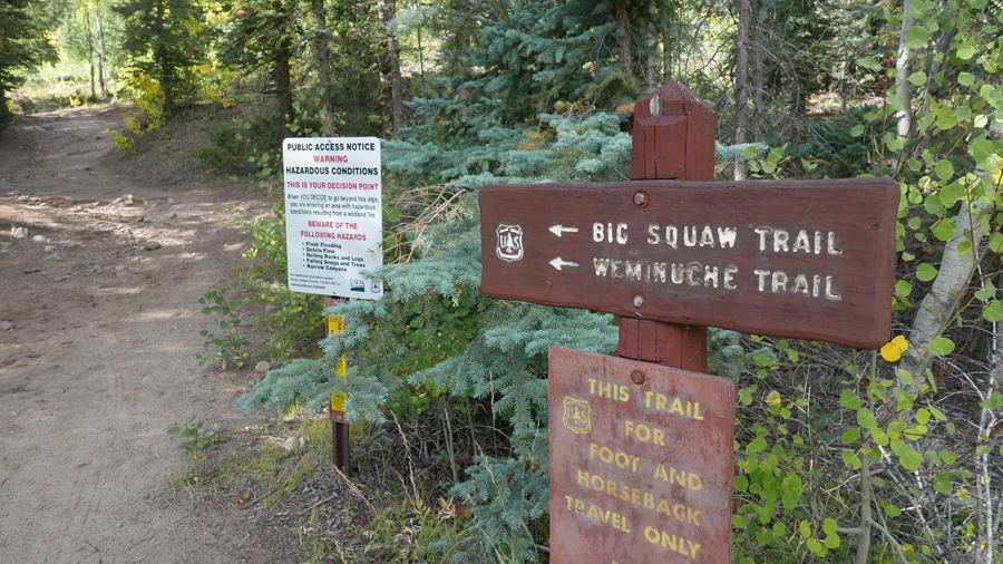
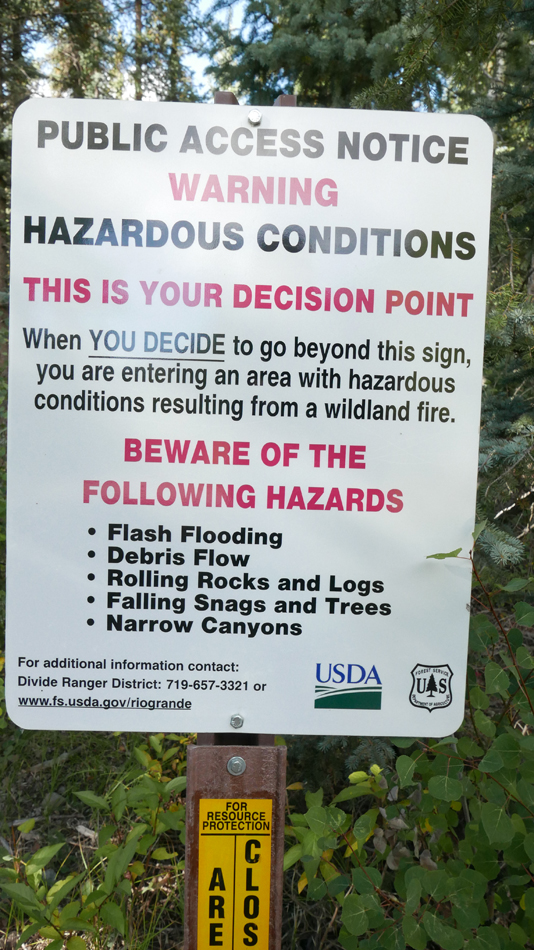
And seeing this sign didn't make me feel exactly warm and fuzzy about what I was getting myself into:
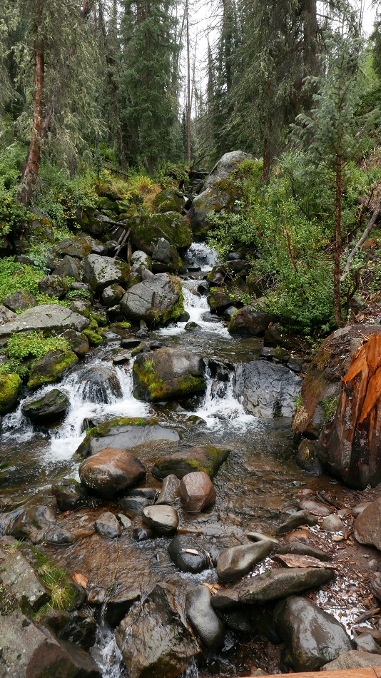
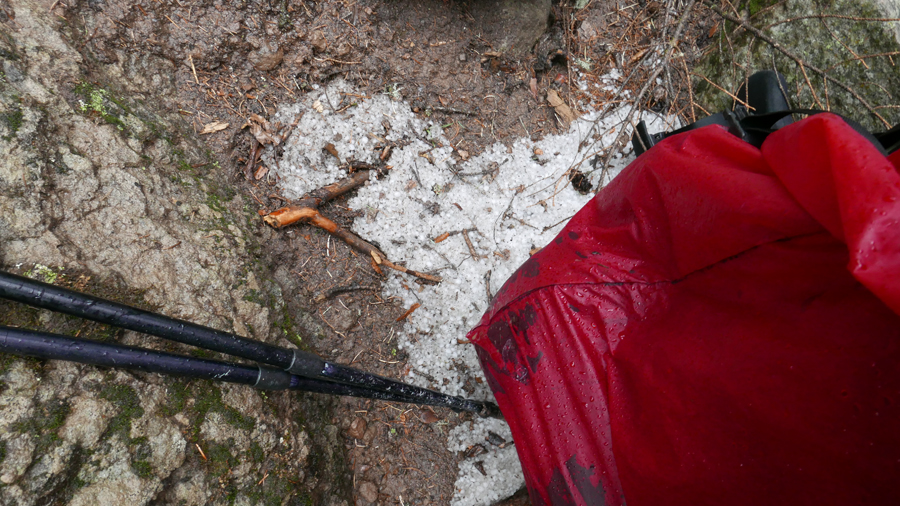
As I headed up the Weminuche Creek trail, the rain let up, but everything was wet and slippery and signs of the passing squall remained:
I was thankful for my red pack cover, for more reasons than rain protection...
... as moments later a 4 horse, 3 mule pack train of hunters passed me going out. I stepped aside to let them pass and in a thick southern drawl one of them thanked me and told me to have a blessed day. OK, I'm definitely not in the Sierra anymore...
Eventually the trail opened up and the sky cleared and I could focus on lugging my pack up to Weminuche Pass, which was my destination for the night and pretty much the only spot for miles that had any sort of decent flat, non-lumpy spots to set up a tent (lack of good spots would become a continuing theme in the days to come).
I was feeling OK and looking forward to finally getting a peaceful, long night's sleep, but the universe would conspire against me yet again...
a nice rest spot along the way to the pass looking back down towards the trailhead:
- Log in to post comments
Top of Page Bottom of Page PermalinkFull Name: Johnny D
DAMN, Hall!!!
DAMN, Hall!!!
Right from the opening statement onward. At least I know that you survived your adventure (based on the fact that you're sharing this with...unless a ghost writer is doing this from your notes - hoping that this is not a Krakauer cautionary tale).
Looking forward to following this developing story.
Top of Page Bottom of Page PermalinkFull Name: Zzzzzz
https://www.youtube.com/watch
https://www.youtube.com/watch?v=POCUgBSVENQ
Top of Page Bottom of Page PermalinkFull Name: |-|/-\|_|_
I got to the pass after a 6
Hey JohnnyD, hey Zang!
so I got to the pass after a 6 mile hike and was looking for a spot to pitch my tent when movement caught my eye...
I thought I was pretty lucky to get so close, but as it turned out, that buck and this doe were the resident wooks, stalking anyone in the area for sweets.
Not long after I set up my tent, another horse camper, who was camped a few hundred feet away came over with cig in hand and struck up a conversation. Turns out this old, griselled dude from Oklahoma was there to pack out any kills his 2 compatriots, a father/son duo from Texas, might bag. But the father/son team were not there... the son was diabetic and had forgotten his insulin and had to bail back out and go to the hospital (where he spent 3 days) after almost going into a coma.
A little later the father/son team arrived and they came over and asked me to join them for coffee. I thankfully declined and I'm pretty sure they thought I was wuss, but it was getting dark and I didn't want to be all caffeined out. Then they told me they were going to hobble their horses and that they would be "wandering" around.
Hobbled horses and deer mooch... shot taken from my tent:
I didn't think too much of it until they started doing the hobble horse stomp near my tent. Fearing for my well being, I would turn on my headlamp and tell 'em to get lost, which would elicit LOUD neighs from the Palomino and clanging of the bells worn by the mules as they made their way off into the night, only to return and do the whole dance over again until around 2am when they finally settled down.
So I had another shitty night and and since the horse packers were oblivious to what they caused, I just packed up and left without saying anything.
Thankfully, it was a nice clear morning that gave me my first look the 14,000'-ish Rio Grande Pyrmid, a mountain that dominates the area and would 'be with' me for many of my hikes:
After a mile or so, I had reached the junction of the Continental Divide Trail, which I would be taking North for the next couple of days:
Looking up at my goal for the day, a spot under "The Window" (left of the Rio Grande Pyramid) some 2000 vertical feet above:
a nice stream along the way:
Looking back down at the meadow I had hiked from:
It was right about at this point that my horse packer neighbors caught up to me...
Top of Page Bottom of Page PermalinkFull Name: Johnny D
Gorgeous!
Gorgeous!
Well, maybe except for the cigarette smoke and hooligan horses.
Top of Page Bottom of Page PermalinkFull Name: |-|/-\|_|_
... and the father drawls,
... and the father drawls, "Dang, you're in better shape than my horse!" lol
I asked where they were headed (and planning to go anywhere but there) and they said they weren't sure, but that they needed to be in a certain quadrant that was legal to hunt in and did I know where that quadrant was? I told them I had know I idea and that my maps only showed names of trails, lakes, creeks, etc..
Turns out these guys knew the general area (Ute creek drainage) they needed to be in, but did not have a map or any idea where that was (hey, at least now they had insulin). So I broke my map out, showed them our location, Ute creek, and how to there. The guy was trying to memorize the map, so I suggested he take a picture of the map with his phone. "That's a dang good idear", he said, "could you point to where we are?... I'm sure glad someone around here knows!"
As it turned out, the good news was that my destinations for the next few nights were not in the Ute Creek area, but the bad news was that I was going to have to hike 15 miles down the Ute Creek drainage and through the hunting zone to get back to my car. dang.
Thankfully, my attention was on my next camp spot under The Window, which I had really been looking forward to seeing up close:
Sunset on the Rio Grande Pyramid:
After my first good night's sleep, on a nice flat spot, I was recharged and up pre-dawn to capture the sunrise:
Top of Page Bottom of Page PermalinkFull Name: |-|/-\|_|_
>>>hooligan horse
>>>hooligan horse
lol, great name for a punk Neil band.
Top of Page Bottom of Page PermalinkFull Name: treat island
Oh boy, Hall, this is good!
Oh boy, Hall, this is good! Can hardly wait for the next installment.
(Hey Johnny D, are you coming back to finish the tale of this year's travels? Did I miss it?)
Top of Page Bottom of Page PermalinkFull Name: |-|/-\|_|_
As I started hiking that day,
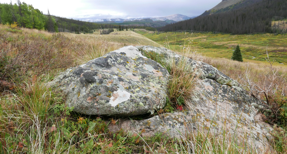
As I started hiking that day, I actually chuckled out loud when I saw this rock, know it was probably a close as I was going to come to a stealth bomber on this trip (sorry, Kai).
Top of Page Bottom of Page PermalinkFull Name: Subway Token
he man silverback hiker can
he man silverback mountian hiker can carry a mule on his back
Top of Page Bottom of Page PermalinkFull Name: Lucky Day
Thanks for documenting the
Thanks for documenting the trip. Good read and nice shots
Top of Page Bottom of Page PermalinkFull Name: Johnny D
I love the changing light and
I love the changing light and colors. Like Monet, but just a bit clearer.
Judit, I'd like to continue on the travel story, but my family has been working me hard lately. Thanks for asking, though.
Hall, I'm just looking at those photos again. Ahhhh....
Top of Page Bottom of Page PermalinkFull Name: Barrel Aged
We were just talking about
We were just talking about you last weekend, wondering how your adventure was panning out.
Beautiful shots...like the 'window', how cool is that?
Thanks for taking us along on your trip, these travel logs sure are fun. How much did your pack weigh?
((resident wookie deer))
Top of Page Bottom of Page PermalinkFull Name: |-|/-\|_|_
Hi Judit!
Hey Judit!
Thanks, Timmy, though I'm not so sure how good of a read it is.lol
Nice to see you Jamjuice, and yeah, the window is wild. Pack was upwards of fitty pounds (I had 8 days of food/fuel on top of winter gear and creek crossing shoes that I never needed). :/
So this day's hike was a tale of 2 zones, one up high on the Continental Divide Trail (CDT), and one lower through sometimes brushy mushy areas.
Since I was already camped up at 12,600', it didn't take long to reach the top of this portion of the CDT (the Window is just out of view on the upper right):
I love this type of zone... it can look like the moon, but there's usually some really cool life forms eeking out an existence:
And this is where I got my first view into the heart of the Weminuche Wilderness and the mountains I would be up against that very night:
panning right, my goal for the day was to camp right under the peaks in the middle of the pic:
panning further right to the lakes in the Ute Creek Drainage/hunting zone and my eventual exit path:
The Continental Divide Trail... pretty amazing that one side drains to the Pacific, and the other to the Atlantic:
Looking back at the ridge I had just been on (to the right of the pic), the Rio Grande Pyramid (upper left) and the "backside" of The Window:
From the CDT, I would take the Flint Lakes Trail which would lead me to the West (left) down into this really beautiful group of clean alpine lakes:
In hindsight, I wish I had camped there for the night instead of pushing on... it would have possibly spared me from what was to come...
but I kept going through sometimes heavy brush on a trail that was sometimes hard to follow.
I eventually had to stop and camp on a slopey, lumpy spot near small, muddy lake. The next water was pretty far away, and there was no good camping spots there anyway (as I found out when I hiked past it the next day), so I was kind of stuck and shit was about to go south, but at least it was beautiful.
Top of Page Bottom of Page PermalinkFull Name: Philzone Refugee
Great photos, Hall, and a
Great photos, Hall, and a damn fine read. Thanks!
Top of Page Bottom of Page PermalinkFull Name: Ken D.
Nice pics. Thanks for
Nice pics. Thanks for sharing.
Top of Page Bottom of Page PermalinkFull Name: St. Mark
Awesome, Hall.
Awesome, Hall.
I'm curious- have you tried sauna as part of your recovery program?
Top of Page Bottom of Page PermalinkFull Name: Subway Token
Why does shit always go south
Why does shit always go south and not another direction?
Top of Page Bottom of Page PermalinkFull Name: Lance HTT Newberry
>>>and shit was about to go
>>>and shit was about to go south<<<
Don't tell me... I have to buy the VIP subscription the get the rest of the story, right?
What a tease.
Top of Page Bottom of Page PermalinkFull Name: |-|/-\|_|_
As I was pumping water out of
Lance, what the fuck, it's only a buck...
As I was pumping water out of the lake with my brand new First Need filter, I noticed a leech wiggling/undulating by. It brought back buried memories of my youth when my family lived in Colorado and we would sometimes get then on us when swimming in lakes... nasty vile fuckin' creatures.
But I wasn't planning to swim here, plus I was beginning to notice that it was getting really difficult to pump water through my filter. Of course I was keeping the intake well above the muddy bottom, but the water was still really silty (same with most of the creeks I would later attempt to pump from) and it began to dawn on me that my filter might be about to seize up and leave my high and dry. Literally.
Muddy lake:
But I had been using this brand of filter since they first came out way back in the 80's when I worked a backpack shop and the only other option was iodine tabs. And while I had had experiences with them getting well used and slowing down, that usually took multiple trips and I never had one totally seize, so I figured I could make this work for the rest of the trip.
Well, that would turn out to be wrong, but I didn't know that yet, so I went on my way, going deeper into the range.
It rained a little that night, but by morning the sun was out, so it was not too cold, and I had reached the big mountains, so I was pretty stoked:
And as I made my way down the Rock Creek Trail, more amazing mountains came into view:
As I dropped down to the Vallecitos Creek trail, there were some amazing Aspen groves. Unfortunately, I was using a new camera (another 2 plus pounds w/batteries, filters, and mini tripod) and I failed to change the setting from it's native 'multi zone' metering to a spot meter, so it 'chose' to focus on the tress in the foreground, leaving the Aspens out of focus. :( Oh well, guess I'll just have to go back:
Top of Page Bottom of Page PermalinkFull Name: |-|/-\|_|_
My route was basically a big
Thanks for stopping in and for the compliments, everyone. :)
My route was basically a big circle with one offshoot halfway through that would take me some 25 miles out to Columbine Pass and into the Chicago Basin and back. After a hard 6 mile downhill hike, I had reached the point where I had to decide whether I was going to turn left and go down Vallecito Creek and do that extra 3 day segment, or skip it and turn right and go up Vallecito Creek and back to the CDT trail.
My knee was getting stronger and the swelling was way down, but I the weight of the pack and the lack of proper training was really slowing me down, so I knew it was probably going to become a death march if I went left.
But it was the pump that made decision a no brainer. During that day's hike, I had had 2 more chances to attempt pumping water from streams, and each time it got more difficult to pump.
So in the interest of not having to resort to boiling water in my small titanium cup (which takes 15 to 20 minutes of boiling at altitude to kill giardia) I turned right and headed up Vallecito Creek and on to the Nebo Creek Trail/Colorado Trail/Continental Divide Trail. I was OK with my decision since the Chicago Basin can also be easily accessed from the Durango/Silverton train (dayhike or overnighter), something I would like to do anyway.
-------------------------------------------------------------------------------------------------------------------------------------------------------------------------------------------------
I had read some scary reports of the Nebo Creek crossing with the potential to get swept off a waterfall if you fall. That's one of the main reasons I carried a pair of New Balance river shoes (light, but still an extra pound) There were supposedly at least 4 other creeks I would have to coss as well.
As it turned out, the water was way down (which contributed to the silt). I only saw a handful of hikers the whole time I was there, so there just aren't that many people to give reports.
The falls at the crossing:
Top of Page Bottom of Page PermalinkFull Name: |-|/-\|_|_
After pushing up a steep hill
After pushing up a steep hill through sometimes dense brush (this it the Colorado/Continental divide trail?), I reached an awesome spot near Nebo Pass. I would have gladly hung out here for a few days, but it was another 15 or so miles to the car and I was already rationing water not knowing when the filter would pump it's last.
But I really enjoyed the afternoon, evening and following morning here... it was pretty incredible.
Looking back down at the deep canyon I had just hiked up from (wraps from left to right in this pic). I always marvel at how big and far away things look, and yet most of what can be seen here can be reached on foot within a day.
Observing the ever changing light is one of my favorite things about these trips:
Not sure what these cool flowers are, but we have them out here in the Sierra, too.
After an amazing night's sleep, I was up pre-dawn to see if I could capture the sunrise on the big peaks to the West. The clear skies aren't nearly as dramatic as when it's stormy, but still pretty damn nice:
asdf
Top of Page Bottom of Page PermalinkFull Name: .............
Great stuff....sacred ground
Great stuff....sacred ground
Top of Page Bottom of Page PermalinkFull Name: |-|/-\|_|_
Usually I drink a quart of
Usually I drink a quart of water from the time I get to camp and go to bed, then another quart during night and with breakfast, but since I was barely able to pump 3 quarts, I decided to just drink half a quart between dinner and hiking out, leaving me with 2 and a half quarts for the 15 mile hike out. Of course I had to carry the water weight, when normally I only carry half a quart while hike since refill spots are usually abundant. So basically the weight in food and fuel I had eaten over the past 4 days was now back on my back. woohoo.
And up until then, I had only been doing 6 to 8 mile days, so I knew this was gonna be a long hard day, but I took some time to soak in the view in the warm morning light before heading over the Divide and down into the hunting zone for what would be a good 10 hour hike.
Mt Nebo on my way up to the pass:
looking back from near the pass:
Heading over the pass; I can once again see the Rio Grande Pyramid and the Window.
Soon I was back in the brush zone! We only have this stuff near creeks, so thrashing through this stuff for long stretches was a new experience for me and one I would not want to repeat, especially in tick season (I was checking for ticks constantly anyway).
Pyramid and window once again in view.
My hike would take me down through the meadows to the bluffs at the far end of the pic.
After hours of tromping through dense forest in the hunting zone with my read pack cover on my pack and talking out loud (I AM NOT AN ELK, DON'T SHOOT ME, etc), I finally got to the first meadow and caught my last view of the Pyramid and Window:
I crossed paths with 2 hikers who said they had moose (one male, one female) in their camp at a nearby lake stalking them for food the night before (a mooch of moose), but unfortunately I never got to see any large critters other than the wookie dear.
But I did see something almost as cool:
I was finally back down into the Aspen zone and when half full Rio Grande Reservoir came into view, I knew I was close:
All I had left to do was cross the lazy river...
Rio Grande River:
Top of Page Bottom of Page PermalinkFull Name: |-|/-\|_|_
The large grass parking area
The large grass parking area that had been mostly empty when I dropped my truck off was now half full with RVs towing horse trailers and at least a few loud drunk hunters (again with drawls) blabbering on about inane shit. I usually don't have much tolerance for just normal chit chat when I first come out of the wilderness, so this seemed extra obnoxious. I ended up driving my truck a little ways away to take a quick sponge bath, but I made sure to keep within view of the area as the storm clouds made for some really interesting spot lighting on the bluffs:
Top of Page Bottom of Page PermalinkFull Name: Good Trouble
>Not sure what these cool
>Not sure what these cool flowers are, but we have them out here in the Sierra, too.
could be Columbine
welcome home and thanks for sharing the story and photos.
Top of Page Bottom of Page PermalinkFull Name: |-|/-\|_|_
It had been a really long day
It had been a really long day and since I didn't want to arrive at my next stop in the dark, I decided to car camp at Thirty Mile Camp located on the South end of the lake (where my hike began). It's an nice quiet spot if you are ever out that way. There are also cabins just under the bluffs in the previous picture that I plan to go to when I'm too broken down to hike or ride a horse into the back country. It's an awesome spot.
So the next day I drove to the very scenic mountain town Ouray by way of Montrose. It was a longer route than backtracking to Durango, but I wanted to basically drive around the whole range and see it from as many viewpoints as possible. Ouray also has a large pool complex fed by hot mineral water, which sounded really good to me. Before I hit the pools I called my wife and told her to watch for me on their real time web cam which I had been using it leading up to the trip to watch the weather in the area. Later she told me it made her really happy to see me, especially after worrying about me going to such a remote wilderness area alone. The pools are awesome, with an adult only section with a hot waterfall to soak aching shoulders and neck. I highly recommend going to this town and pools.
Stock picture from Google Images:
After soaking and swimming in the cold pool for a few hours, I was famished. I had previously researched the area and decided I had to try the Green Chile at a place called Buen Tiempo. It was excellent and I really wish I could get it out here.
Speaking of which, the town of Ouray is named after the Ute Chief Ouray, who was known as the peacemaker, but according to local lore, some of his descendants still continue the Green Chile vs Chile Verde argument with at least one of them who contends that there is no difference between the two (crazy, I know).
Chief Ouray (in his custie suit):
After dinner, I strolled up and down the streets sipping a chocolate milkshake and I saw that there was a dispensary AND a backpack shop. Both were closed, but since I had nowhere to be, I decided to camp in my truck around there for the night and hit the shops in the morning.
I got the last spot up on the side of the mountain above town at Amphitheater campground (another place I would highly recommend) and awoke to a nice sunrise on the cliffs above:
Back in town, I was brought up to speed on (and purchased) the Sawyer water filter (same one los Peakers use). I learned that not only is it way lighter and more compact, it can also be back flowed and cleaned in the field with a syringe or smart water bottle. This is not possible with other filters and in theory I should never have to worry about having one clog again (but I'll still take some iodine caps just in case).
I also learned that Ouray voted to make week illegal and that the smoke shop only sells CBD oil and bongs. Bummer, maaaan (and I wondered what the Telluride airline rant/conspiracy guy would have to say about it).
So I headed out of town on scenic Hwy 550 through towards Purgatory (Durango mountain) and Durango figuring I would stay there for the night, then drive to Flagstaff the next day.
Along the way I got some views of the other side of the Weminuche Wilderness, but as far as I could make out, there are not many roads that will get you too close up (though there is the train that goes along the Animas river).
And out in the middle of nowhere, there was a grow facility, so I stopped and picked up a doob of sour diesel for the drive to Durango, which also had a pretty cool shop:
But it wasn't even noon yet, I was not really all that into spending more time in Durango (or any town), so I decided, what the hell, I'll drive to Flagstaff, which only took me about 5 and a half hours, so I decided to head on over to Needles and maybe camp next to the Colorado river, but I was still pretty amped when I got there so I decided to press on for Barstow.
And since I had had to cut my Colorado trip short, I had been hatching a plan to head up hwy 395 and use my extra days hanging out in the Sierra, so when I was gassing up in Barstow at midnight, google told me it was only a couple more hours to Lone Pine. Not wanting another bedbug filled night in Barstow, I slammed a Red Bull and threw a '72 show on and started driving.
I knew I had made the right decision when the first song of the show was Truckin' and later when I was able to wake up here and not in Barstow:
^Whitney Creek Campground (Lone Pine) is one of my favorite reservable place anywhere with great views of the Whitney Crest:
I hit up the Ranger station there in Lone Pine for a map and an overnight permit for an area I had never been to: the South fork of Big Pine creek, featuring 14,000' Middle Palisade:
The reason I had never been up this trail is that it dead ends about 7 miles in, so it's pretty much only good for overnighters. The hike is not too tough, with only only semi-brutal wall:
When I got to camp I was pretty beat (the long drive and only a couple hours sleep had caught to me), so I set up the tent and did something I never do: I took an afternoon nap. When I woke up, it was time for food:
And then it was right back to bed as this moon was setting:
The next day I hike up to Brainerd Lake and got a closer look at the glaciers... I missed seeing ice, something the San Juans don't have much of.
Top of Page Bottom of Page PermalinkFull Name: treat island
Not Columbine, but maybe a
It's not Columbine, but maybe a form of Indian Red (or just Red) Paintbrush?
Top of Page Bottom of Page PermalinkFull Name: MarkD
Wow! Great thread Hall!
Wow! Great thread Hall! Super sweet photos. Thanks for sharing.
And yeah, what's up with that JohnnyD?
Top of Page Bottom of Page PermalinkFull Name: |-|/-\|_|_
All in all, it was great to
I loved the Weminuche, but it was great being back to my familiar setting...
^One last shot of beautiful middle Palisade Crest.
After hiking back out to the car, I drove up to Yosemite and camped in my truck in the backcountry parking area near Toulumne Meadows.
There was some weather moving through the next morning so I took some pics of the sunrise on Cathedral Peak, had a greasy breakfast at the cafe, and drove down to Yosemite Valley in search of warmer weather.
I ended up hiking and climbing around El Cap for a couple hours before taking a swim in the Merced and driving home.
It was a great trip overall. I learned some things about myself and I'm already looking forward to the next one (with some lighter gear).
And if you read this far, you're almost as big a glutton for punishment as I am...
Top of Page Bottom of Page PermalinkFull Name: Lord Kalvert
great shots my man - thnx
great shots my man - thnx
Top of Page Bottom of Page PermalinkFull Name: Lord Kalvert
one of my Whitney shots in
one of my Whitney shots in 2011
Top of Page Bottom of Page PermalinkFull Name: skifurthur
If Hall doesn't win ZotY for
If Hall doesn't win ZotY for this tread, there is no Jah.
Top of Page Bottom of Page PermalinkFull Name: I rang a silent bell
It’s a beautiful thing.
It’s a beautiful thing.
Top of Page Bottom of Page PermalinkFull Name: I rang a silent bell
It’s a beautiful thing.
Love your pictures HAL, awesome!
Top of Page Bottom of Page PermalinkFull Name: Def. High
Great thread!
Great thread!
Top of Page Bottom of Page PermalinkFull Name: GravyTrain
tl;dr
tl;dr
but some good pics. Interesting how they serve chile verde in a chili bowl. ;) I’ll be sure to try some next time I’m out that way.
Top of Page Bottom of Page PermalinkFull Name: ...
Breathtaking shots
Breathtaking shots
thanks for bringing us along
Top of Page Bottom of Page PermalinkFull Name: Stone
50 pounds, no bueno.
50 pounds, no bueno.
Top of Page Bottom of Page PermalinkFull Name: Stone
Great job Hall. We have over
Great job Hall. We have over 700 pictures from our trip. I guess I should just settle in and go through them.
Top of Page Bottom of Page PermalinkFull Name: DNB - Best band & fans in the land!
Hall, thanks for putting us
Hall, thanks for putting us in your pack and letting us tag along on your hiking trip!
hmmmm... maybe THAT'S why your pack seemed so heavy, man
Top of Page Bottom of Page PermalinkFull Name: Lance HTT Newberry
>>>you're almost as big a
>>>you're almost as big a glutton for punishment as I am<<<
Not even close my man. Not even in the same league. I live vicariously through you/these threads.
And on that note, what the hell Peak?!!!?
We want photos and hellish stories, and we want them now!
Top of Page Bottom of Page PermalinkFull Name: Zzzzzz
Beautiful shots man. Next
Beautiful shots man. Next time invite a few of us.
>>>that buck and this doe were the resident wooks
Lines ya don't hear every day.
Top of Page Bottom of Page PermalinkFull Name: Blue Rose Task Force
Strong work Hall !!!!
Strong work Hall !!!!
Thanks for sharing your BEAUTIFUL journey
Top of Page Bottom of Page PermalinkFull Name: Andean Flight
Awesome thread, Hall. Thanks
Awesome thread, Hall. Thanks for sharing the pics and the story. I enjoyed both. I've been pretty lazy about backpacking and camping since my kids were born, but this definitely makes me want to get out into the mountains more often.
Top of Page Bottom of Page PermalinkFull Name: Lord Kalvert
I love the San Juans- first
I love the San Juans- first laid eyes on them on a trip to Telluride in 1984- on the highway from Moab.
Top of Page Bottom of Page PermalinkFull Name: |-|/-\|_|_
Thanks again, y'all! Both
Thanks again, y'all! Hoping NedB will stop by... he's the one who turned me onto the Weminuche...
>>>50 pounds, no bueno.
Never again, Peak!
But that means no more long trips with the potential for Winter weather... it had just snowed pretty heavily in the North part of the state, so I was not comfortable with my usual ultra light tent and bag (which meant an extra 4 pounds), plus I added a few extra layers and river crossing shoes that I never carry in the Sierra.
And the 9 days of food and extra fuel crammed into my oversized bear canister was like a freakin' cinder block, but I knew it would get lighter everyday and for this reason I had planned the longest hiking days for later in the trip. Unfortunately the early exit nixed that.
The new water filter system will shed almost a pound (when you count the nalgene bottle I no longer need), and I'm trading my 20 year old, 7lb cordura Osprey pack for the latest model (Aether Pro) that only weighs 4lbs, so I expect to be down in the mid 30's next year for an 8 day Sequoia trip I've had planned out to Colby Pass (to check out the Kaweahs) and back via South America Lake (entering/exiting via Shepherd Pass near Independence).
And Zang, if you're serious, let's talk... concerthall at yahoo dot com.
Top of Page Bottom of Page PermalinkFull Name: Barrel Aged
That photo with the orange
That photo with the orange mountains at sunrise, wow. Three cheers for super-human bad-ass hikers!!
I made a pack upgrade 2 years ago and love it. Made of durable sail material, I can hold it up empty with my pinky. 1.78# These are a tad pricey, but you can find lightly used ones around.
https://www.hyperlitemountaingear.com/ultralight-backpacks.html
Top of Page Bottom of Page PermalinkFull Name: Subway Token
killer thread buddy.
killer thread buddy.
you may have just out documented johnnyd
Top of Page Bottom of Page PermalinkFull Name: Philzone Refugee
A couple of questions:
A couple of questions:
You mentioned a lack of "proper training" contributed to your decision to curtail your trek. What would your normal training be for a hike like this?
As you were alone, what was your plan if your knee gave out or you had some other issue halt you out in the backcountry? Were you in range of cell phone towers?
Top of Page Bottom of Page PermalinkFull Name: |-|/-\|_|_
JohnnyD is the benchmark...
JohnnyD is the benchmark...
Thanks, Jamjuice, that shot is pretty much my favorite style of photography which I learned about from the late, great Galen Rowell, who taught the (not new) concept of blending warm/hot and cool/cold elements, which is not something cameras do very well since they tend to only be able to capture one or the other (whereas our eyes/brain can see the two elements no problem).
With the use of split neutral density filters, I can effectively 'slow down' the intense warm light from the orange mountains, which allows the camera the longer time it needs to properly expose the cool green and blue hues in the foreground (of course this also requires a tripod).
Camera 2lb setup I used:
Top of Page Bottom of Page PermalinkFull Name: |-|/-\|_|_
Dave, I'm a former bike racer
Dave, I'm a former bike racer and still get in around 10 to 12 hours a week (an hour or two after work 4 days a week, and a long ride on Saturdays that can range anywhere from 50 to 160 miles with 5000' to 15000' in elevation gains).
So I'm fit, especially aerobically, but of course hiking uses different muscle groups, so around 3 weeks before a trip I usually load up a day pack with 25 pounds and hike up and down some short steep hills for an hour every other day, and then hike along the sloped, loose, rocky section next to the railroad tracks the other days.
In the past, this has been enough to 'wake up' the hiking muscle groups enough to get me through the first few days on the trail, and after that I'm usually able to truck all day no problem.
And I carried a Garmin InReach with SOS that synchs up with their satellite network anywhere in the world if I need rescuing. ..
Top of Page Bottom of Page PermalinkFull Name: Philzone Refugee
That makes perfect sense.
That makes perfect sense. Thanks for the insight, and again for a fascinating and enjoyable travelogue.
Top of Page Bottom of Page PermalinkFull Name: Barrel Aged
You lost me at split neutral
You lost me at split neutral density filters...but I'm going to say that it's definitely worth the 2 lb set up. And here I thought it was just a lucky shot, well done.
Top of Page Bottom of Page PermalinkFull Name: |-|/-\|_|_
That is the rectangular
Those are the rectangular filters mounted in front of the lens. They are clear on the bottom half and dark on the top half and can be slid up and down in the holder and are neutral in color (so they doesn't add color).
In that sunrise shot, I slid filters up so that the dark part 'covered' the orange/hot mountains at the top of the frame leaving the clear part of the filters over the cooler foreground.
Without the filters it would have only been about a 60th of a second exposure (at F16), but with the filters I could set a longer exposure time (1/2 a second, I think?) and that extra exposure time is what allowed the otherwise too-low-light-for-a-camera foreground to be captured more like our eyes would see it.
It took me many years to understand all this, and I'm still learning (especially about making adjustments in Photoshop, as I was primarily an old school film guy), but it's pretty rewarding when I do get a shot like that.
And found out that this camera only needs a new battery every 3 days, so I can leave half of the batteries behind next time, which will hopefully bring it down to under 2lbs. :)
Top of Page Bottom of Page PermalinkFull Name: Johnny D
Hall, Kai got a chuckle from
Hall, Kai got a chuckle from your stealth rock.
I haven't had the time to read your narrative, but WOWZA on those photos.
LUVIT!!!
Top of Page Bottom of Page PermalinkFull Name: |-|/-\|_|_
Right on, hava good weekend!
Right on, hava good weekend!
Top of Page Bottom of Page PermalinkFull Name: ParadiseWaits
Incredible photos, Hall! Wow!
Incredible photos, Hall! Wow!
Top of Page Bottom of Page PermalinkFull Name: Sound and Vision
Amazing beauty in this thread
Amazing beauty in this thread, thanks for sharing Hall's excellent adventure!
Top of Page Bottom of Page PermalinkFull Name: Strangha
Great thread. Thanks for
Great thread. Thanks for posting all those pictures and taking us along, Hall. Sounds like a great experience for you.
Saw this quote yesterday and thought of you.
The farther one gets into the wilderness, the greater is the attraction of its lonely freedom. --Theodore Roosevelt
Top of Page Bottom of Page PermalinkFull Name: Racketinmyhead
Great thread. This are the
Great thread. This are the best threads the zone offers. Thanks hall
Top of Page Bottom of Page PermalinkFull Name: Mylar
Awesome, Hall!
Awesome, Hall!
Top of Page Bottom of Page PermalinkFull Name: |-|/-\|_|_
bump for Ned... thanks again
bump for Ned... thanks again for the recommendation, I'm already planning more trips in the area.
Top of Page Bottom of Page PermalinkFull Name: ...
I never hike... .
I never hike... .
We did the Devil's Causeway Loop today with my son (did the steep descent vs climb)
It rained a little & snowed after we crossed the Causeway which thrilled my son, the snow can't arrive soon enough for him.
Thanks for the thread Hall, It was inspiring
Top of Page Bottom of Page PermalinkFull Name: ...
Our son was our guide for the
Our son was our guide for the day
Top of Page Bottom of Page PermalinkFull Name: |-|/-\|_|_
That looks F'n amazing,
That looks F'n amazing, Voodoo, glad you guys were able to get out there before the snows come.
Top of Page Bottom of Page PermalinkFull Name: GravyTrain
Snubbedb
Snubbedb
Top of Page Bottom of Page PermalinkFull Name: |-|/-\|_|_
not the first time, either.
lol, it wouldn't be the first time...
Top of Page Bottom of Page PermalinkFull Name: New & Improved
YES the Triple Lindy of snubs
YES the Triple Lindy of snubs!
Hey Hall....looks like you did it right (except for the water filter part). Didn't you know Amazon supplies water drops via drone out there in the Weminuche?
The seasons turn early in August. Glad you got some good weather. Nothing like spending extended time above treeline (that's timberline for all you cow farming VT'ers). Sky Zone FTW!
Top of Page Bottom of Page PermalinkFull Name: |-|/-\|_|_
Damn, I bought the filter
Damn, I bought the filter through Amazon, but didn't know about the H2O drone (it probably only comes with Prime).
An M&M drone would be pretty cool too...
Top of Page Bottom of Page PermalinkFull Name: Barrel Aged
Just scrolled through your
Just scrolled through your pics again because they are so darn cool. Place looks amazing.
Now if I could get a Jameson's drone drop every 4 days, that would save me from carrying 1.6#
Top of Page Bottom of Page PermalinkFull Name: |-|/-\|_|_
Maybe look into getting a
Maybe look into getting a Jameson's Llama until they get that particular drone technology down?
Top of Page Bottom of Page PermalinkFull Name: Barrel Aged
Speaking of llama's, my
Speaking of llama's, my brother (who did not finish this years JMT section due to lack of training) said he was getting 2 llamas for our next section (104 miles) and even costed it out at $96 x 2 llamas / day that can carry 60# each. I was laughing because I thought he was kidding. He was not. {cough}....loser....{cough}. So oddly enough, I may just have a llama carry my booze next year, lol.
Top of Page Bottom of Page PermalinkFull Name: |-|/-\|_|_
I recognize those two... the
I recognize those two... the one of the left is Ritter and the one on the right is Banner.
(sorry)
hey, so what JMT section are you guys doing next?
Top of Page Bottom of Page PermalinkFull Name: Barrel Aged
I'll admit, the llamas are
I'll admit, the llamas are pretty darn cute.
We are thinking of combining sections 3 and 4 next year, total mileage is 104 over 11 days (Start at Vermillion Valley Resort - End at Kings Canyon). But after this years' early exit due to fires, we might plan an alternate route like you do. Just in case CA is on fire again.
Top of Page Bottom of Page PermalinkFull Name: Stone
...
...
Top of Page Bottom of Page PermalinkFull Name: Lance HTT Newberry
>>>{cough}....loser....{cough
>>>{cough}....loser....{cough}<<<
Wait, who's the loser in that story? Your brother?
What's wrong with paying for a llama to carry all your shit? Wouldn't it be a more enjoyable walk without lugging 279 pounds of crap on your back?
Personally I wouldn't enjoy it with llama or without llama, but if I HAD to do it I would pay a lot for a llama.
I'M PRO-LLAMA!!!
Top of Page Bottom of Page PermalinkFull Name: Barrel Aged
Says the guy that thinks
Says the guy who thinks roughing it is staying at the Holiday Inn. ;)
I'm just digging on my little brother who is spending $2k on pack animals when he could totally outfit himself with ultra-light gear instead. Call me a purist, I see the advantages, but this still sounds like cheating.
Will I be a bit jealous? Maybe. Will I be hiking eye level to llama butt? No way.
Top of Page Bottom of Page PermalinkFull Name: |-|/-\|_|_
>>>Vermillion Valley Resort -
>>>Vermillion Valley Resort - End at Kings Canyon
I love that JMT section, especially the areas leading up to, over, and down the passes. How many days to you have? Have you done any of it before?
>>> Will I be hiking eye level to llama butt? No way.
From what I hear, the other end isn't much better (don't they spit like their Camel cousins?).
But I will seriousleliee be considering the llama thing when I'm too old to carry a pack, unless I graduate directly to hiring horse packers to drop me and my gear off at some high basin and picking me up a week later.
In the mean time, here's the weight I will be dropping from that pack (with semi-Winter gear) I took to CO:
Pack: - 3lbs (20 year old, 7lb opsrey Ariel 70 to a new 4lb opsrey Aether Pro 70)
Tent: -2lbs (4.8 lb Bibler iTent to a 1lb 11oz Nemo Hornet 1 person)
Sleeping bag: -1.3 lb (3.5 lb winter down bag to 2.2 lb summer down bag)
H2O purification: - .5 lb (First need to Sawyer squeeze)
Food: -4lbs ( 7 days of food instead of 9. also limiting a few comfort foods)
Bear Canister: -.3 lbs (large canister to medium sized carbon fiber/titanium)
Stove/fuel: -.5 lbs (MSR Whisperlight to PocketRocket w/smallest fuel canister... just to cook ramen every other dinner)
Sleeping pad. -.25 lbs (ThermaRest Prolight Plus to Thermarest Prolight)
Items that will NOT be included: +/- -3.5 lbs... River wading shoes; ultralight fleece vest; long finger wool hiking gloves; 2nd (and 3rd, lol) set of 3 spare AAA batteries; 2 extra camera batteries (so a total of 3 instead of 5... new camera lasted 3 days per battery!); mini lock blade knife; emergency flip phone (just taking the Garmin InReach from now on); Nalgene 1 quart bottle.
That's a total of around 15lbs I'll be shedding, which should get my 7 day pack down to a very manageable 35 pounds to start, and under 30 for the 2nd half of the trip!
So I'm pretty stoked! And even though it's still not an ultra-light setup by any means (I'm still not ready to give up certain comforts, mostly in the food department... at 6', 165lbs, I don't have much in the way of built in food stores, so if I don't keep shoving a pro/kynd bars down my gullet, I get the bonks real bad).
>>>I'M PRO LLAMA!!!
Really? I had you pegged as an Ocelot kinda guy...
Top of Page Bottom of Page PermalinkFull Name: Lance HTT Newberry
Staying at a Holiday Inn IS
Staying at a Holiday Inn IS roughing it. Their in-room coffee is terrible.
Top of Page Bottom of Page PermalinkFull Name: Across
Nice thread.
Nice thread.
Spent much time in the Weminuche back in the day, great spot for long hikes. Chicago Basin is killer. Got stuck in a blizzard about 100 ft from the top of Sunlight Peak up there while trying to bag the three 14ers up there. Hiked one way from Vallecito back out to Purgatory. This was back when I smoked cigarettes and could still out hike my semi pro mtn bike riding buddy. Used to drive him nuts when I'd be waiting for him up ahead while a cig hung from my lip. We brought a quarter with us and smoked it by day two up in the basin. Long hike out with no herb but got hooked up by the kind gentleman who gave us a ride back to Durango.
Thanks for a trip down memory lane
Top of Page Bottom of Page PermalinkFull Name: Barrel Aged
Across good story, you could
Across good story, you could have shown the Smoky Mountains a thing or two.
Hall, I never answered your question. I blame the disruptive schedule of grape harvest, it's sticky up in here.
Look at all that weight you just dropped with the first three items 6.3lbs, nice. I nixed gloves too and switched to a light neck knife. I get tired of nutra bars a few days in.... now peanut butter pretzels...heavy but heavenly.
This part of the JMT is new to me and I am stoked. We are doing the 2 sections in 11 days, maybe more days after the last butt kicking, but that is the plan. You are welcome to do some or part with us. I'm sure our group will not be as large/crazy in 2019. There may be llamas. Or do you have something else up your sleeve for your next adventure?
Top of Page Bottom of Page PermalinkFull Name: |-|/-\|_|_
Thanks for the invite! I'm
Thanks for the invite! I'm still planning to do the Shepherd pass>Kaweah trip in September (or CO again if there's smoke), but I may be able to get a few extra days off work and 'pop' over Lamarck Col and join you for the Muir Pass segment (one of my favorites)... are y'all going in August again?
Top of Page Bottom of Page PermalinkFull Name: Barrel Aged
That was the trip you were
That was the trip you were originally going to do this year, right?
We usually shoot for last weekend in July, based on getting our hands on permits. That would be great if you can come and share a few miles!
My camera skills need improvement.
Top of Page Bottom of Page PermalinkFull Name: |-|/-\|_|_
Cool pic, but I look at that
Cool pic, but I look at that trail and shudder thinking of hiking it in sneakers....
And yes, I'm hoping to do the basically the same trip.
It would be really cool to hike a few days with you guys if I can swing it. If, at some point before February (when permits become available), I can get the approximate date of when you will be heading up from Evolution Valley into the Evolution Basin/Muir Pass area, I will try for a North Lake permit.
Top of Page Bottom of Page PermalinkFull Name: Stone
Would be cool if you could
Would be cool if you could join us Hall. I hike in what are basically sneakers. Altra Lone Peaks, I am very comfortable in them. The only problem I have with the latest version is the amount of very fine dirt that penetrates the skin of the shoe. Last years model not so much.
Top of Page Bottom of Page PermalinkFull Name: Sound and Vision
Stunning photography, Hall!!
Stunning photography, Hall!! Thanks for sharing your journey!
Top of Page Bottom of Page PermalinkFull Name: |-|/-\|_|_
Thanks, Windy!
Thanks, Windy!
Peak, you're beaming! Is that along the section South of Red's Meadow?
And I really appreciate the invite. As mentioned, I just need the approximate dates that you'll be passing through the Evolution area before the permits become available in Feb. (I'll try for a permit for 2 and see if I can drag Turtle along, if that's OK with y'all).
In the meantime, let's see some more pics!
Nebo Pass on the Colorado Trail/Continental Divide
Top of Page Bottom of Page PermalinkFull Name: Stone
That picture was on the way
That picture was on the way to Mono pass. Ruby lake in the background.