Oregon ~ Portland Wind and Fire Sept. 2020
Forums:
Thought I'd start a thread, there's a lot of info starting to fly around, many warnings.
This one is from Facebook: Portland: Heads up!
Just wrapped up one of the busiest shifts I’ve worked in my nearly 18 years in the National Weather Service. After a long year of dead weather, I feel alive again
* Portland is seriously looking down the barrel of a severe fire weather event later tomorrow through Wednesday - one that, if it occurs how forecast models have been consistently been portraying for the past 2 days, will be the kind of fire weather event the Portland area only sees once every 50+ years.
* Our forecast is on the conservative side, but still ridiculous for this time of year. East winds, developing later tomorrow, then gusts increasing to 35-45 mph in the metro area and gusts 60-80 mph in the hills. Meanwhile, relative humidity drops to around 10-15% by Tuesday and perhaps into the 5-10% range if the drier forecasts come true.
* If you’re from Sonoma County and this sounds familiar, it should. It’s essentially the same type of weather pattern that caused fire to rage into Santa Rosa in Oct 2017.
* If you’re in Portland, don’t be surprised if your power gets shut off sometime Monday and/or Tuesday. This is the kind of event that may cause power companies to de-energize their power lines to prevent them from starting fires if they get blown down. Such a fire destroyed neighborhoods in my hometown of Santa Rosa.
* I can already imagine the conspiracy theories that would fly on both sides of the political spectrum if power gets shut down. If anyone tells you it was Antifa or white supremacists or China who shut down power, please laugh at their face for me. It’s being done to keep us safe.
* Remember: No spark, no fire. No fire, and we’ll get through this without tragedy. For those who remember Sep 2017 and the Eagle Creek Fire, this appears to be 25-50% stronger than the wind event that caused that fire to spread nearly 20 miles in one night. That “weaker” event caused flaming embers from Oregon to blow across the massive Columbia River and started a fire 1-2 miles away on the Washington side.
* There will probably be some damage from the wind alone. Branches will break, and debris that has gathered since it was last windy will be shaken down. If this event turns out to be as strong or stronger than current models suggest to me, we could see occasional East wind gusts 45-55 mph IN PORTLAND.
* If the higher-end projections pan out, this will be a very memorable wind event with gusts potentially as high as 60-70 mph in Portland. With trees still green and fully leafed out, this would cause a significant amount of damage.
* In case you can’t tell - I’m am EXTREMELY nervous about this event. It has Portland Firestorm written all over it. Let’s be smart and make sure thar doesn’t happen.
* Stay safe and smart out there. Hopefully it turns out that we’re all over-forecasting this event. But I’m going to make sure my cell phone is charged tomorrow through Tuesday, that’s for sure.
- Log in to post comments
Top of Page Bottom of Page PermalinkFull Name: Druba
Portland NWS offices 4am
Portland NWS offices 4am discussion;
<<.SHORT TERM...Today through Wednesday...Forecast appears to be very well on track this morning, with strong east to northeast winds expected to develop across much of the forecast area later today. As such, we only made minor changes on this shift. The synoptic features models have been portraying for days are becoming evident on satellite and surface observations. High pressure is indeed strong over northern British Columbia at nearly 1040 mb. Meanwhile, 3.9 um thermal satellite imagery clearly shows very warm conditions along/near the Oregon Coast south of Cape Blanco, maintaining a thermal trough of low pressure there. North Bend to Spokane MSLP gradients remain weakly onshore, but that will be changing soon - and rapidly - as the strong B.C. high pushes south into the Interior Northwest. In other words, all the ingredients are coming together as expected for a potent and likely historic September East Wind event in our forecast area.
The strongest east winds still appear to focus through the gap in the high Cascades between Mt Adams and Mt Hood (sort of the broader Columbia Gorge area) across western portions of the Columbia Gorge, Portland/Vancouver metro area, north Oregon Coast and Coast Range. While high resolution guidance has generally backed off ever so slightly with the magnitude of this event, 00z NAEFS and EPS means continue to show the type of event that only occurs a couple times a century in September. 00z NAM/GFS are still forecasting Spokane to North Bend MSLP gradients of 21 to 23 mb late tonight and early Tuesday morning, with 900 mb east winds of 65-75 kt over Portland. Any weakening in the models` projections for this event has only put the expected wind speeds down into the ranges we`re forecasting - if they had remained in the 23 to 26 mb range with 75-85 kt 900 mb winds over Portland, we would have had to increase our forecast. As such, confidence is only increasing that 40 to 60 mph east wind gusts will develop through the corridor mentioned at the beginning of this paragraph, with gusts 60 to 80 mph expected on exposed ridges. In other words, the High Wind Warnings currently in place look to be in great shape, and no changes were made on this shift.
The existing Red Flag Warnings also look to be in good shape. We are on track for an extremely dangerous period of fire weather beginning this afternoon, as discussed below by the evening shift. The rare combination of an easterly downslope windstorm and extremely low relative humidities have led the Storm Prediction Center to put the area mentioned above into a rare "Extremely Critical" category in their Day 1 Fire Weather Outlook.
We will be issuing a Heat Advisory starting 4 PM this afternoon until 10 PM Tuesday for the coast Tillamook southward and the central Coast Range of Oregon, where high temperatures in the 90s will be common once the east winds arrive. The timing of this advisory is a bit tricky, as some portions of Oregon`s Central Coast may remain cool and cloudy today until the east winds arrive sometime this afternoon or evening. It`s entirely possible many coastal locations south of Lincoln City will see their temperatures rise tonight as offshore winds develop. Offshore winds will persist through the day Tuesday, holding off any sea breeze which could cool off the immediate coast.
Top of Page Bottom of Page PermalinkFull Name: Philzone Refugee
Top of Page Bottom of Page PermalinkFull Name: Druba
Been fun watching the dry /
Been fun watching the dry / cold front head south / west towards Western Oregon
At 3pm pacific time, the front appears to be crossing the Oregon cascades heading westward (dewpoint in Hood River 37º, Troutdale 58º), and heading south in western Washington (Olympia dewpoint 40º, Vancouver WA 57º).
At 4pm; Troutdale dewpoint down to 53º
Winds at 3pm are generally sustained in the 20mph range with gusts in the 30's behind the front on the west side of the Cascades in Washington; While sustained in the 30's with gusts to close to 50mph in Eastern / Central Washington. (Rattlesnake Ridge in WA was gusting to 75mph at noon)
Eastern Oregon has similar winds right now... all heading western Oregon way, expect the winds to continue to increase thru 4 am
4pm winds;
Astoria NE 18mph
Scappoose N 13 G 20
Corvallis NE14 G 21
Eugene N18
Creswell NW10 G 17
Troutdale E9
Hood River E14 G23
Dalles E22 G38
Pendleton N32 G47
Top of Page Bottom of Page PermalinkFull Name: Druba
5pm, Portland now East winds
5pm, Portland now East winds 27mph with gusts to 37mph, dew point 40º, so we have frontal passage... winds should be increasing!
(at 4pm, Portland winds NW at 7mph, dewpoint 57)
Top of Page Bottom of Page PermalinkFull Name: MeditateontheQ
Thanks Noodler... just
Thanks Noodler... just returned from a drive... winds are picking up in Portland now... a huge sheet of plastic landed on the car hood while on I-84...but worse yet, the smoke from Mt Jefferson fire has covered Portland... could only see the Big Pink building on the skyline.
Hope our trees survive the wind.
Top of Page Bottom of Page PermalinkFull Name: Druba
Have friends reporting on how
Have friends reporting on how bad the smoke got to our north, as it comes down from the NE... you could actually see a wall of brown an hour ago just to our north, now we're in it...
Top of Page Bottom of Page PermalinkFull Name: treat island
My daughter-in-law posted a
My daughter-in-law posted a picture of the smoke as they're on the freeway near Portland. Looks scary terrible.
My sisters in the bay area say that the air quality there is continuing to be really shitty. If only we could flee for our lives but there's really nowhere to go...
Top of Page Bottom of Page PermalinkFull Name: Druba
Smokes now in Cornholio, can
Smokes now in Cornholio, can't see the mountains, and even the buildings / dorms within a half mile away are going bye bye
Meanwhile, 6pm winds in Portland are now east at 36mph, with gusts to 47...
Based on the dewpoints, the dry front is between Salem and Corvallis at 6pm
Top of Page Bottom of Page PermalinkFull Name: Druba
Getting totally smoked out
Getting totally smoked out now (and the winds have picked up)
here's a 6:30pic
And a few minutes later at 6:43, visibility down to a few blocks.... (and it reeks of smoke)
After uploading, it's 7pm, and the visibility is down to literally 2 or 3 blocks, with the wind blasting!
Top of Page Bottom of Page PermalinkFull Name: MeditateontheQ
Good thing WCZJ was last
Good thing WCZJ was last weekend!
Top of Page Bottom of Page PermalinkFull Name: Def. High
10 m. W. of Corvallis, in the
10 m. W. of Corvallis, in the foothills:
Vis. about 1/2 mile in heavy smoke. Temp. at 81.
We usually open the windows at this time of day to cool off the house - we only have one-room ac - but can't do it today. Have one cat still out - hope he comes in soon.
Top of Page Bottom of Page PermalinkFull Name: Druba
(I just turned the exhaust
(I just turned the exhaust window fan off, closed that window, as the wind blowing against it was overwhelming it, brought way too much smoke inside in literally 2 minutes)
Getting reports of ash with the smoke in Lebanon... (it's bad out in Bend too!)
Top of Page Bottom of Page PermalinkFull Name: Def. High
Sky is yellow now, but I don
Sky is yellow now, but I don't think the sun is blue.
Top of Page Bottom of Page PermalinkFull Name: Druba
http://aqicn.org/city/usa
http://aqicn.org/city/usa/oregon/corvallis/
Top of Page Bottom of Page PermalinkFull Name: MeditateontheQ
PGE just turned off Mt Hood's
PGE just turned off Mt Hood's power and NE Portland also lost power.
Smoke is bad enough indoors that I'm thinking of getting a hotel room!
Top of Page Bottom of Page PermalinkFull Name: Druba
Smoke now entering the Eugene
Smoke now entering the Eugene area, visibilities down to a mile....
Occasional ash falling in Corvallis, w/ more on the east side of the valley...
The Lionshead fire expected to cross onto the west side of the cascades tomorrow fueled by the strong winds... my buddy w/ a cabin near Marion Lakes was told by the ranger it could be the last time he sees it...
Top of Page Bottom of Page PermalinkFull Name: treat island
Smoke is definitely here, it
Smoke is definitely here, it came very quickly. It's windy here with gusts but not too strong. The smoke really sucks.
Top of Page Bottom of Page PermalinkFull Name: treat island
Thanks for the reports,
Thanks for the reports, Noodler. Hey Oregononians, remember to wear filtration masks like N95's if you can. Did I say the smoke really sucks?
Top of Page Bottom of Page PermalinkFull Name: Druba
Air quality index for
Air quality index for Corvallis now 384, or hazardous (just took a brief walk w/ the surgical mask on, got ash in my eyes!). Albany is at 534, that's nasty!!!
Eugene area went from the 40's to the 188-288 range
(portland area 150's - 180s)
Top of Page Bottom of Page PermalinkFull Name: treat island
Where are you getting your
Where are you getting your air quality readings? I'm looking at various sites and there's inconsistency, to say the least.
Stay safe out there!
Top of Page Bottom of Page PermalinkFull Name: Vann Kliburn
I got my air quality readings
I got my air quality readings 10 mins ago when I took out the trash- still coughing .
Pretty bad out there.
Top of Page Bottom of Page PermalinkFull Name: Druba
I posted a link above Judit,
I posted a link above Judit, you can zoom out to see other sites... hasn't updated for a few hours, but it's raining ash outside right now, and the Lionshead fire has exploded so bad, it's now visible on radar, with the plume coming into the mid / south valley... it's going to be nasty for 24 hours I bet, likely longer....
Top of Page Bottom of Page PermalinkFull Name: Druba
A long time friend, and
A long time friend, and fellow deadhead, is being evacuated just east of Salem (Gates), as small fire has appeared near his place (multiple reports of small fires all over the region right now)
Top of Page Bottom of Page PermalinkFull Name: Druba
Smoke plume on radar, moving
Smoke plume on radar, moving into the valley... a very bad sign!
Top of Page Bottom of Page PermalinkFull Name: Druba
My buddy's been safely
My buddy's been safely evacuated (the cat's not happy, LOL)
(some "fire" tunes)
https://www.youtube.com/watch?v=fCBsbj8X1JU&fbclid=IwAR2ITxO9YmMcrzILc2O...
https://www.youtube.com/watch?v=C4a40FjB_sM&fbclid=IwAR2ITxO9YmMcrzILc2O...
https://www.youtube.com/watch?v=en1uwIzI3SE&fbclid=IwAR2ITxO9YmMcrzILc2O...
https://www.youtube.com/watch?v=ikGyZh0VbPQ&fbclid=IwAR2ITxO9YmMcrzILc2O...
https://www.youtube.com/watch?v=9lpFeopjJhI&fbclid=IwAR2ITxO9YmMcrzILc2O...
Top of Page Bottom of Page PermalinkFull Name: Sycamore Slough
Wishing all of the Fire
Wishing all of the Fire-Affected folks in PNW the best of Luck and Safety.
Stay safe and Happy
Top of Page Bottom of Page PermalinkFull Name: Druba
Evacuation orders on the
Evacuation orders on the McKenzie
https://www.klcc.org/post/oregon-wildfires-evacuation-order-blue-river-u...
Top of Page Bottom of Page PermalinkFull Name: Druba
Gates / Detroit Res now a
Gates / Detroit Res now a level III evacuation, Brietenbush Hot Springs level III evacuation....
Top of Page Bottom of Page PermalinkFull Name: treat island
Oh shit, Breitenbush again?
Oh shit, Breitenbush again? And up the McKenzie, We spent weekend up at some friends' place on the River while Greg was doing chemo and then after that for years as it worked for us, about a half mile before Paradise Campground. It seems like the evacuation is only going up to the ranger station. I hope that is so because we were just a little beyond it.
somehow, the smoke feels and tastes thick in my house with the windows closed. The skylight is open, maybe that's part of it.
Top of Page Bottom of Page PermalinkFull Name: Druba
At midnight, Eugene had
At midnight, Eugene had easterly winds of 21mph, gusting to 31mph, hard to keep the smoke out when it's that windy.... my place is pretty smokey, and I shut everything up hours ago....
Top of Page Bottom of Page PermalinkFull Name: Druba
All of the Santiam canyon
All of the Santiam canyon from Cliff dam to Mehema is at level III evacuation.
Top of Page Bottom of Page PermalinkFull Name: Druba
This link has some of the
This link has some of the smaller fires on it (takes a while to load up)
https://www.fireweatheravalanche.org/fire/
Top of Page Bottom of Page PermalinkFull Name: Def. High
Really bad air here. Can't
Really bad air here. Can't let the cat out in it - he's been howling since 5:30. Can't use ac or house ventilation - brings smoke into the house.
Top of Page Bottom of Page PermalinkFull Name: Rasputin O'Leary
Terrible the only game in
Terrible the only game in town
Top of Page Bottom of Page PermalinkFull Name: KeseyB
Kayaked Siletz River
Kayaked Siletz River yesterday; gorgeous day! A river otter poked it's head up to watch us. Nice section of the river, from Ichwhit park both directions.
Drove back, right into the pink-grey smoke. Crazy sight. Closed all windows at home, (including skylights!) Today the car is covered in smoke. A sign of changing times.....
Top of Page Bottom of Page PermalinkFull Name: Ken D.
Winds and smoke were
Winds and smoke were incredible last night here. Had to sure up a bamboo fence to keep it from toppling over and moved some of the outdoor plants to under a carport to keep them from being damaged. Smoke is much better this morning but still getting some big gusts. Lots of debris and power/street lights still out during much of my morning commute. They preemptively cut the power off up at Mt. Hood and surrounding communities to mitigate the chance of fires.
Hope everyone up in the foothills are ok.
Top of Page Bottom of Page PermalinkFull Name: Vann Kliburn
Salem at 9 AM
Salem at 9 AM
No clouds -- just orange smoke - never seen anything like it.
Top of Page Bottom of Page PermalinkFull Name: Dan
Damn, it looks like a large
Damn, it looks like a large stretch of the McKenzie Highway is closed and fire is on both sides.
Top of Page Bottom of Page PermalinkFull Name: Dan
From Mexico to Canada, I've
From Mexico to Canada, I've never seen something like this.
Top of Page Bottom of Page PermalinkFull Name: treat island
Good morning. When I woke up
Good morning. When I woke up at 7:00 the sky all around was an extremely bright orange and it lasted for a while. I went back to sleep and when I got up again it was just dirty gray/yellow/orange as it still is. Lots of ash on all surfaces, no wind to speak of, and I'm going to have to wear an N95 mask today, even in the house to give my lungs and throat a break. We are very lucky to not live like this in our usual lives.
The NOAA hourly forecast for today says east wind 20 mph with gusts to 35 mph this afternoon.
2020
Top of Page Bottom of Page PermalinkFull Name: Druba
Rumors of Mill City getting
Rumors of Mill City getting hit hard last night, and cabins are burning at Breitenbush
Corvallis had an orange fog this morning, ash over everything, still nasty out...
Smoked out on satellite
Top of Page Bottom of Page PermalinkFull Name: MeditateontheQ
Ugh.... all three of the
Ugh.... all three of the places I spent time at last week are in danger or covered in smoke.
I'm most distressed about Breitenbush property and the McKenzie River communities -- just confirmed that Hwy 126 is closed from Springfield / Eugene all the way to Belknap hot springs (like a 90 minute drive from point to point).
The cold front pushed the smoke away and I can see blue sky (SW Portland)... but looks like the high winds will last at least until 6pm.
Top of Page Bottom of Page PermalinkFull Name: Druba
(No subject)
Top of Page Bottom of Page PermalinkFull Name: Druba
(No subject)
Top of Page Bottom of Page PermalinkFull Name: Druba
My buddy Josh just took this
My buddy Josh just took this picture on I-5 south of Salem
Top of Page Bottom of Page PermalinkFull Name: MeditateontheQ
Whoa! Much scarier looking
Whoa! Much scarier looking than in Portland. Feeling for all the animals right now, too.
Top of Page Bottom of Page PermalinkFull Name: Druba
We've had 1/2 mile visibility
We've had 1/2 mile visibility (or less) since 6:30 pm yesterday
(there's ash piles in the alleys where the leaves normally collect)
Top of Page Bottom of Page PermalinkFull Name: treat island
I keep trying to take
I keep trying to take pictures of the swirling ash through dirty double pane windows, not working.
Top of Page Bottom of Page PermalinkFull Name: Druba
Ash on the flytraps
Ash on the flytraps
Top of Page Bottom of Page PermalinkFull Name: MeditateontheQ
McKenzie River bridge is
McKenzie River bridge is burning.
Blue River community has lost 80-100 homes.
From Belknap Hot Springs (east of the bridge) north up to the junction w/ Hwy 20 to Sisters, people are on Level 2 evac notice. Level 3 is "must go, don't take your stuff"
Top of Page Bottom of Page PermalinkFull Name: Sycamore Slough
Had friends in the Hwy 126
Had friends in the Hwy 126 area in Blue River and Vida regions back when, and random Wildfires were usually further out toward Cascades and high desert regions.
Basically many homes closer to the McKenzie River, fewer North of hwy. 126, but lots of Conifers to burn hot if ignited.
If I had a place near the River, I'd be pumping water all over my lot / house to prevent a Blaze.
Top of Page Bottom of Page PermalinkFull Name: treat island
I've read that the town of
I've read that the town of Blue River is burned over, gone. This is becoming more and more traumatic.
Top of Page Bottom of Page PermalinkFull Name: MeditateontheQ
...and this from @OregonDOT :
...and this from @OregonDOT : Interstate 5 Exit 1 northbound into Oregon: I-5 is closed to northbound traffic at the border due to the Ashland area fire. Traffic is being turned around back into California.
Top of Page Bottom of Page PermalinkFull Name: Druba
Holly and Crawfordsville
Holly and Crawfordsville (Calapooia River) are on notice for possible evacuation, and the news from Mill City looks bad
(Everyday great guy Sam Elliott lives out in that area)
Top of Page Bottom of Page PermalinkFull Name: Ken D.
>>>>The news from Mill City
>>>>The news from Mill City looks bad
Here is news video. Looks like the town is gone.
https://www.youtube.com/watch?v=RFLip4LUyy4
Top of Page Bottom of Page PermalinkFull Name: MeditateontheQ
The Governor's news
The Governor's news conference confirmed that the total acreage of *just* the Santiam Canyon fire is roughly four times the size of the Eagle Creek (in the Gorge) fire in 2017!
Top of Page Bottom of Page PermalinkFull Name: Druba
McKenzie fire info from the
McKenzie fire info from the county
https://www.lanecounty.org/cms/one.aspx?pageId=17035134
From Lane, Linn, and Marion county sheriffs offices;
Lane County: Level 2 BE READY Evacuation for all residents in the entire Marcola/Mohawk Valley, including Camp Creek and Upper Camp Creek to Linn County line.
McCully Mountain is on a LEVEL 3 Evacuation. Evacuate NOW!
The area North of Highway 226, and East of Stayton-Scio Road is under a Level 2 Evacuation Advisory. Be prepared to evacuate should it become necessary.
The area East of Cascadia along the Highway 20 corridor is under a Level 2 Evacuation. Residents are advised to prepare in the event that a mandatory evacuation becomes necessary.
The Sheriff's Office also asks the public to avoid all unnecessary travel on Highway 20.
******UPDATE*******
Current Level 3 evacuations: This is a Go order
Lyons,
Mehama,
Detroit,
Idanah,
214 North of Silverfalls State Park to Scotts Mills
Current Level 2 evacuations: This is a get ready to Go order
Stayton,
Sublimity,
Aumsville,
213 West Mt Angel Silverton to Drakes Crossing.
Hwy 22 continues to be closed from the city of Stayton through the Santiam Canyon. If you have to evacuate, you will be allowed to get out of the canyon, but no one will be able to return.
Red Cross is set up at the Salem State Fairgrounds located at 2330 17th ST NE Salem, OR 97301
They are accepting animals and livestock.
• (If you have livestock , please enter on the south side of the fairgrounds)
Deschutes County Fairgrounds 3800 SE, SE Airport Way Redmond, Or 97756
NOTE: WE ARE HAVING TROUBLE WITH OUR COUNTY NETWORK, WE ARE WORKING TO FIX THIS ASAP.
Top of Page Bottom of Page PermalinkFull Name: joy
Salida Colorado 9/8/2020
Salida Colorado 9/8/2020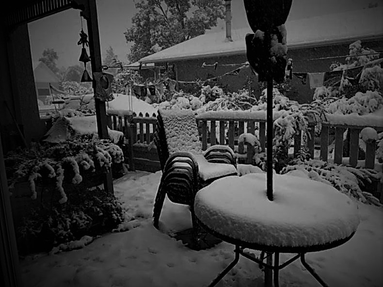
Top of Page Bottom of Page PermalinkFull Name: MeditateontheQ
^^^ funny, was just dreaming
^^^ funny, was just dreaming about snowshoe / ski season!
Top of Page Bottom of Page PermalinkFull Name: treat island
A little bit ago, the Holiday
A little bit ago, the Holiday Farm fire east of us and Springfield was already 37,000 acres...
The smoke is very thick, the ash continues to swirl, the wind comes and goes.
The real-time air quality index measurement nearest my house is 468 according to Noodler's link.
Top of Page Bottom of Page PermalinkFull Name: Def. High
From what I gather, we should
From what I gather, we should see slow improvement in the air quality as the winds lay down a bit tonight and turn a bit more northerly on Wed. It will be hotter, though - upper 90s at least. Thursday wind should go NW and some cooling will ensue.
Fire danger will still remain extreme or very high - be careful out there. Putting together a bug-out plan and box for the first time EVER.
Top of Page Bottom of Page PermalinkFull Name: treat island
539
539
Top of Page Bottom of Page PermalinkFull Name: treat island
I am packing a bag to go, but
I am packing a bag to go, but don't know where I'd go. Crazy times.
Stay safe, Surfdead and J. And Noodler, and keseyb, and really, all of us Oregonians and beyond.
Top of Page Bottom of Page PermalinkFull Name: MeditateontheQ
Take care Surfdead! If you
Take care Surfdead! If you need a place to crash in Portland, let me know.
Oregonians will appreciate these freaky fire images of the Enchanted Forest on I-5....
Top of Page Bottom of Page PermalinkFull Name: Localcountyline
Ok Judit and
Ok Judit and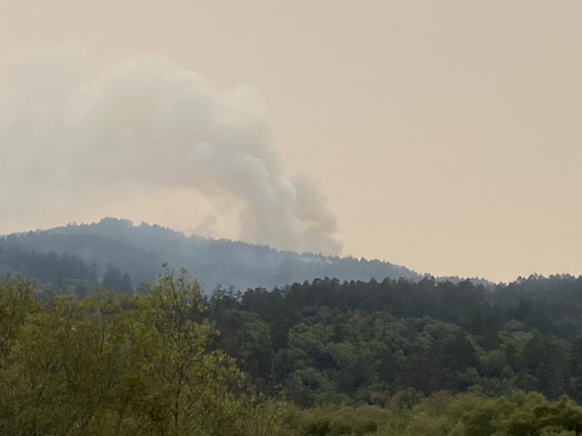
all of you Oregon folk, try to stay positive and hope for the best. Kind of powerless to do anything else.
I took this a couple hours ago in Pt. Reyes. Fire is contained; I think they are letting this part burn itself out.
We're thinking of you down here in CA.
Top of Page Bottom of Page PermalinkFull Name: I rang a silent bell
Hang in there Judit and all
Hang in there Judit and all OR and CA Zoners in the smoke. Hoping for a positive change in the forecast!
Top of Page Bottom of Page PermalinkFull Name: MeditateontheQ
Judit you are welcome here
Judit you are welcome here too. Trundle beds w/ Surfdead, LOL
Top of Page Bottom of Page PermalinkFull Name: Druba
https://www.eugeneweekly.com
https://www.eugeneweekly.com/2020/09/08/vida-and-blue-river-communities-...
Top of Page Bottom of Page PermalinkFull Name: treat island
I wish my phone camera would
I wish my phone camera would've captured the smoke here (before night fell).
I read that Eugene Weekly piece earlier and didn't want to trust it. I don't want those places to be gone.
Thanks, dear LLOLLO. I think my best idea is to pack as though I were going somewhere and stay here.
Top of Page Bottom of Page PermalinkFull Name: Druba
The forest fires are so hot
The forest fires are so hot they're showing up on IR satellite (the smoke plumes are no where near as bad on radar as last night, and the winds are starting to wane a bit)
Top of Page Bottom of Page PermalinkFull Name: Druba
Evacuations in the Methford
Evacuations in the
MethfordMedford areaTop of Page Bottom of Page PermalinkFull Name: Druba
KOBI live FB stream of the
KOBI live FB stream of the Medford fires
https://www.facebook.com/kobitv/videos/2790437481191592
Top of Page Bottom of Page PermalinkFull Name: Druba
Pics taken near Happy Camp
Pics taken near Happy Camp
Top of Page Bottom of Page PermalinkFull Name: Druba
Clackamas County Wildfire
Clackamas County Wildfire Evacuation Zones
https://ccgis-mapservice.maps.arcgis.com/apps/webappviewer/index.html?id...
Top of Page Bottom of Page PermalinkFull Name: Ken D.
Down in Southern Oregon, the
Down in Southern Oregon, the fires burnt through Talent, which is a pretty big town, and is now hitting Phoenix.
This is bad. Really bad.
{{{Rural Oregon}}}
{{{Rural Oregon Zoners}}}
Top of Page Bottom of Page PermalinkFull Name: Druba
Watched several videos from
Watched several videos from Talent, the Home Depot and a Burger King are gone, fortunately a friend's safe who lives there...
Top of Page Bottom of Page PermalinkFull Name: Druba
Time lapse of the smoke
Time lapse of the smoke hitting Corvallis
https://www.facebook.com/kezi9/videos/813153726159902
Top of Page Bottom of Page PermalinkFull Name: Druba
Talent, OR
Talent, OR
Top of Page Bottom of Page PermalinkFull Name: treat island
Oh that is really terrible
Oh that is really terrible and terrifying. What the hell is going on? Best hopes for lives saved.
Top of Page Bottom of Page PermalinkFull Name: Druba
The videos from Talent are
The videos from Talent are horrific... so many memories from down there, freaking insane! (may not want to watch)
afternoon
https://www.facebook.com/krissie.g.shaw/videos/10217824928995394
evening
https://www.facebook.com/richard.felker.3/videos/10158642573112829
night
https://www.facebook.com/GuatyGuat/videos/10158577399766420
Top of Page Bottom of Page PermalinkFull Name: MeditateontheQ
Judit what is the situation
Judit what is the situation near you today?
Also for all > Pass along this website to friends in evac zones -- it's the Red Cross site to mark yourself safe: https://safeandwell.communityos.org/cms/index.php
Top of Page Bottom of Page PermalinkFull Name: Philzone Refugee
The smokey haze is still
The smokey haze is still lingering in Seattle today, but not as thick as yesterday. It is supposed to warm up today and tomorrow, with no onshore flow projected until Saturday. With so many fires burning to the East and South, it will probably stay hazy until the rain front arrives on Sunday. Lots of towns severely impacted in Washington too. The Easterly wind has taken most of the humidity out of the air. It dries out your skin and feels more like a desert climate.
Top of Page Bottom of Page PermalinkFull Name: MeditateontheQ
It definitely does feel like
It definitely does feel like the desert, Herbal! The plants look dehydrated too.
I'm seeing blue sky this morn here in Portland but the wind is still as strong as it was yesterday... high of 90 today, too.
Been moping that this is yet another reason we must stay indoors.
Top of Page Bottom of Page PermalinkFull Name: Philzone Refugee
Fire (Arthur Brown)>
Fire (Arthur Brown)>
Fire On The Mountain>
The Sky Is Burnin'>
Smoke On The Water>
Burning Down The House>
Fire (The Ohio Players)
Top of Page Bottom of Page PermalinkFull Name: Def. High
Less wind today, worse air.
Less wind today, worse air.
We were thinking that if we did have to evac we would go west to Newport, since all the big fires are to the east where the wind and smoke are coming from.
Wife just got a text from her nurse friend down the road that they're calling her back to work right now after working the night shift because North Lincoln Hospital in Lincoln City just north of Newport is evacing due to nearby fires and some or all patients are being sent to the hosp. in Corvallis. We have to go to town later and expect to see lots of cars from the coast.
Top of Page Bottom of Page PermalinkFull Name: treat island
EVACUATION NOTICES | Lane
EVACUATION NOTICES | Lane County evacuation orders remain in effect for the Holiday Farm Fire, which has burned an area larger than Portland, Oregon - and nearly 4 times the size of Eugene - in less than 2 days. This is across the Willamette river, just east of Springfield and Eugene. We think we are safe, hope so. It would be crazy to think that the fire could cross I-5 and the river, but if we remember the Eagle Creek fire where the fire jumped the Columbia River...
Top of Page Bottom of Page PermalinkFull Name: MeditateontheQ
Judit -- can you tell if
Judit -- can you tell if Belknap Lodge is in the level 3 evac zone on this map? I can't tell.
Belknap is east of McKenzie Bridge, but I can't tell where the bridge is or used to be.... :(
Top of Page Bottom of Page PermalinkFull Name: treat island
I can't tell, LLOLLO, but if
I can't tell, LLOLLO, but if it is, it's level 2. It wasn't threatened yesterday. This map is from this morning.
Top of Page Bottom of Page PermalinkFull Name: treat island
There are no new evacuation
There are no new evacuation notices from this morning in our very huge county.
Top of Page Bottom of Page PermalinkFull Name: MeditateontheQ
Thanks Judit, good to hear.
Thanks Judit, good to hear.
I just caught this on Twitter: Mill City, Phoenix, Talent, Gates > Towns are gone
Lincoln City just got an evac notice!!!
Top of Page Bottom of Page PermalinkFull Name: Sycamore Slough
"...It would be crazy to
"...It would be crazy to think that the fire could cross I-5 and the river, but if we remember the Eagle Creek fire where the fire jumped the Columbia River..."
Talked to a friend in Mt. Hood area last night. She's a Forest Ranger at "The Dalles" and mentioned that the fire did actually jump the Columbia River.
Top of Page Bottom of Page PermalinkFull Name: Druba
My buddies home east of Salem
My buddies home east of Salem... getting so many horrific reports, ugly times (and much smokier, dark, ashy today in Corvallis)
Top of Page Bottom of Page PermalinkFull Name: Ken D.
So sad. After a clear
So sad. After a clear morning, the smoke has just returned to Portland.
Lost a limb on one of my indicas from the wind but was telling myself I am so lucky not to be hit like all those folks up the Santiam Valley have. Vibes to all those folks.
Top of Page Bottom of Page PermalinkFull Name: Druba
Linn county no longer has
Linn county no longer has room for Livestock, Benton county still has room and is gladly accepting
Upper Calapooia Rd / Holly area now a level 3 evacuation
Top of Page Bottom of Page PermalinkFull Name: Druba
<<Officials at the Emergency
<<Officials at the Emergency Operations Center have announced a reduction in the Evacuation Levels in South Medford as part of the Almeda Fire.. The Level is now reduced from Level 3 to Level 2 in the following area:
This area is bounded by North Phoenix Road on the east; on the north side the boundary of Barnett Road and Garfield Street and Stewart Avenue; on the West the boundary is Hull Road from Stewart Avenue to South Stage Road; and on the south the boundary is on South Stage Road.
A reminder that these links are available and the latest evacuation maps are there
Links for information:
• Latest evacuation maps: https://jcgis.maps.arcgis.com/apps/webappviewer/index.html?id=3caa39804d...
• Official incident Facebook page:
https://www.facebook.com/jacksoncountyoregonem
• Enter information on missing family or friends: https://arcg.is/014bzS
• Link for people who evacuated and report themselves as safe: https://arcg.is/14vDXC
Additionally, everyone is asked to not try to return to areas where the fire has been in the South County area. The areas are still dangerous and activity is in progress by Law and Fire.
Top of Page Bottom of Page PermalinkFull Name: Druba
^^ Linn county fairgrounds
^^ Linn county fairgrounds no longer has room, Benton county fairgrounds accepting
Top of Page Bottom of Page PermalinkFull Name: Druba
Lincoln County Evacuations
Lincoln County Evacuations
https://flashalert.net/id/LCSO/137736?fbclid=IwAR2rT3VADS4aaJ0LGh7toxbmz...
Top of Page Bottom of Page PermalinkFull Name: MeditateontheQ
Yup, smoke just returned to
Yup, smoke just returned to our neighborhood in the last 30, still very windy. Sky is yellow.
Governor's press conference beginning now! kopb.org
Top of Page Bottom of Page PermalinkFull Name: Druba
Yaquina bridge in Newport
Yaquina bridge in Newport (Corvallis looks the same)
Top of Page Bottom of Page PermalinkFull Name: Druba
Lincoln City evacuation map
Lincoln City evacuation map
Top of Page Bottom of Page PermalinkFull Name: treat island
We have thickly gray air, no
We have thickly gray air, no orange. Lots of ash.
Top of Page Bottom of Page PermalinkFull Name: Druba
More pics of my buddies
More pics of my buddies former home east of Salem
Top of Page Bottom of Page PermalinkFull Name: MeditateontheQ
Willow says she's still at
Willow says she's still at Artfarm!
Top of Page Bottom of Page PermalinkFull Name: treat island
So traumatic to see the pics,
So traumatic to see the pics, especially the losses of people you know. Much love to all.
Top of Page Bottom of Page PermalinkFull Name: Skitime
The entire city of Estacada
The entire city of Estacada just had a level 3 evacuation announced. Holy crap, that isn't that far from Portland.
Top of Page Bottom of Page PermalinkFull Name: Druba
They're evacuating the
They're evacuating the hospital in Lincoln City
Top of Page Bottom of Page PermalinkFull Name: Druba
From my buddy Woody who lost
From my buddy Woody who lost his home...
(i've known Woody for around 35 years, and appreciate him sharing his stories, such horrible shit to live thru, and it wouldn't surprise me if some of you know him too...)
>>
Just got off the phone with breitenbush alumni Scott Johnson and Marybeth Carden.
We are neighbors on the North Santiam River nearto the Mapleton Rest Area and Minto County Park. We both lost our homes to the Santiam Fire.
Scott was the primary designer and builder of the spiral tubs. In 1983 Scott and I built the first rock soak at BHS, now known as the silent pool. One of BHS’s most iconic image.
Scott, Marybeth and Toku the cat are alive and well at a farm south of Salem. Scott said I could relay our phone call.
(Prelude. At about 9:30pm Monday night everyone lost power in the area. I was alerted to the fire on Potato Hill when my neighbor was honking his horn, and I went outside. I tried to call Scott to a busy signal ((no power for landlines)). They live upriver and on the opposite bank. When we first evacuated to the parking lot alongside 22 in front of Canyon Cannabis I waited for them to show up attempting another call to no avail. We eventually left by 1am and I assumed they had as well. I hope to visit in person these next few days, and perhaps we can get them online with a laptop for a few minutes. Here is an abbreviated account of thier experience that I can share.)
Scott and Marybeth lost power and eventually went to bed not knowing what was transpiring. They awoke around 5am for Marybeth to prepare to go to work at the farm they are now staying at.
She quickly awakened Scott, “We have to go - now!” Outside of thier home was a wall of flames. The driveway was blocked leaving no choice but to go to the river. Scott had to run through the flames to get the cat carrier. With the cat they made thier way down the embankment to the river...that too was burning. At one point Marybeth’s clothing was on fire. They got on a log in the river holding the cat in carrier over their head. (If you have entered the river below the dam it is quiet cold.) Fire was on both sides of the river, (and I know the wooded terrain across the river from their house). They were in the water for seven hours. Eventually the fire had consumed their home and property, and they determined it was time to head for 22. Scott had to go look for some kind of rope so went up the drive to other neighbors homes to improvise. by then it was mid-morning and many of the other homes had evacuated and burned. What they encountered was surreal with the understory removed and blackened He found what he needed, and came back for Marybeth and the cat. leaving the river they walked by the smoldering remains of their home and cars, up the drive, and to Railroad ave and then 22. They started to walk towards Gates and eventually encountered responders that transported them to Salem, wet and cold. Their farm friends picked them up and took them to the farm (Albany area). They lost everything but the cloths on their backs and the cat. They have a few first degree burns and some singed whiskers of the cat.
Scott and Marybeth will eventually be able to share their own epic and harrowing experience.
They want you to know they are alive and well and send their love to you and the land.>>
Top of Page Bottom of Page PermalinkFull Name: Ken D.
Damn what a tale. Glad they
Damn what a tale. Glad they made it out and the cat is safe.
Top of Page Bottom of Page PermalinkFull Name: Druba
(No subject)
Top of Page Bottom of Page PermalinkFull Name: treat island
I read about others being
I read about others being brought 7 miles down/in the McKenzie River because the road was impassable.
Noodler, the story from your friend is kind of thing I read that I have to remember to exhale and breathe again.
Estacada! Cities big and small are being threatened. And decimated.
East Springfield, too.
Oh shit, I just saw your air quality, Noodler. Ours is down to 289!
Top of Page Bottom of Page PermalinkFull Name: Def. High
Went to town, got a full tank
Went to town, got a full tank of gas and a few other things. It's crazy out there. Traffic in gridlock or just slow on Hwy. 20 - both ways. Folks evacing from the coast and the upper Santiam in the Cascades - most look like they didn't have much time to leave - cars full of piles of stuff with pet sitting on top. Vis. less than a mile - half the folks driving without their headlights on. Everyone looking confused about where to go. Hard to breathe outside.
Top of Page Bottom of Page PermalinkFull Name: treat island
Surfdead...
Surfdead...
Top of Page Bottom of Page PermalinkFull Name: MeditateontheQ
A prankster / black sheep
A prankster / black sheep family friend just lost his home in Medford area. Awful.
Yes, Wngfan -- I was suprised about Estacada -- only 35 miles away from my house!
Too many fires to fight at the same time.
Top of Page Bottom of Page PermalinkFull Name: treat island
And almost no backup
And almost no backup available west of the Rockies.
Top of Page Bottom of Page PermalinkFull Name: Druba
And yet another fire, this
And yet another fire, this time crossing into Oregon from Cali... my friends in Happy Camp are safe, but looks like the Illinois Valley region is next to be evacuated starting by the border;
<<<
Update: Sheriff's Office personnel are going to the homes of residents who need to evacuate to advise them. Information is being relayed to other agencies involved as quickly as possible in order to disseminate the evacuation updates to the public. Josephine County Emergency Call Center has set up a line to call to get information regarding the fires. The phone number is (541) 474-5305.
JOSEPHINE COUNTY EVACUATION NOTICE
Due to the fast moving Slater fire, all residents from four corners through Happy Camp Road and four corners through Takilma Road are being placed on a LEVEL 3 “GO” EVACUATION. This means you must leave now, you do not have time to gather belongings or protect your home. The Josephine County Fairgrounds is a temporary evacuation point.
Residents of O’Brien are set at a LEVEL 2 “BE SET” EVACUATION. A Level 2 “Be Set” means that you must be prepared to leave at a moment’s notice. This level indicates there is significant danger to your area, and residents should either voluntarily relocate to a shelter outside of the affected area, or if choosing to remain, be ready to evacuate at a moment’s notice.
Residents are highly encouraged to sign up for Citizen Alert, the notification system used by Josephine County to alert users about emergencies via cell phone, home phone, text message or email. For more information, see https://member.everbridge.net/1332612387832182/login or https://www.co.josephine.or.us/Page.asp?NavID=1858.
Top of Page Bottom of Page PermalinkFull Name: MeditateontheQ
Best interactive map I've
Best interactive map I've found so far....unf*ing real... over 475,000 acres burned
https://experience.arcgis.com/experience/6329d5e4e13748b9b9f7f33f06a3c376/
Top of Page Bottom of Page PermalinkFull Name: treat island
Jesus fuck! We're in it, no
Holy shit! We're in it, and no rain for days... I don't mean fire is nearer to where I am, but the map shows so many fires!
Top of Page Bottom of Page PermalinkFull Name: Sound and Vision
crazy and scary.
crazy and scary.
stay out of harm's way westies
Top of Page Bottom of Page PermalinkFull Name: 19.5 Degrees
{{{{ vibes }}}}
{{{{ vibes }}}}
Top of Page Bottom of Page PermalinkFull Name: Druba
The long range forecast has
The long range forecast has the cut-off low that's been a ways offshore for weeks will finally be able to kick out, giving us a chance of measurable rainfall in the northern sections on Monday? / Tuesday? Unfortunately, some of the models show possible thunderstorms with the warm front on Monday... still several days out, and the models doubtfully will take into account all the smoke that's gone out to sea, forming a hybrid airmass of smoke and fog... usually smoke inhibits convection, but there's lots of dust from the cascade peaks going out to sea as well, so will have some curious cloud condensation nuclei action going on for these parts... (rain / fog needs water soluble particles to form on, ice / snow needs non-soluble particles, like microscopic crystals found in soil dust, hence the different shapes of snowflakes)
Top of Page Bottom of Page PermalinkFull Name: MeditateontheQ
Breaking:
Breaking:
CLOSURE: Highway 101 is closed for 16 miles from Hwy. 18 north of Otis to Hwy. 229 in Kernville south of Lincoln City due to a wildfire #pdxtraffic
Top of Page Bottom of Page PermalinkFull Name: Def. High
Actually looking a tad better
Actually looking a tad better right now, smoke-wise. Can see the next range of hills - about 1.5 miles. Lighter sky up above also. Light N. winds. Still worried about fire, oc. Nearest is about 40 miles, but worried that a new fire will spring up nearby. Stay safe out there, folks.
Top of Page Bottom of Page PermalinkFull Name: Druba
A friends lost home in
A friends lost home in Detroit Res.
Top of Page Bottom of Page PermalinkFull Name: MeditateontheQ
Cutting flowers, harvesting
Cutting flowers, harvesting apples, watering the cedars and wetting down anything dry is temporarily calming.
Freaky orange sky is in Portland now.
Top of Page Bottom of Page PermalinkFull Name: Localcountyline
Freaky orange sky in the
Freaky orange sky in the whole Bay Area today.
At 10 am it looked like 6. No one here had seen anything like it.
"Like weather on Mars" and "Apocalyptic" were used a lot today; soot and ash everywhere.
We wish you all the best up there folks.
Top of Page Bottom of Page PermalinkFull Name: MeditateontheQ
Thanks Local and likewise..
Thanks Local and likewise...feeling for my hometown of SF too.
Top of Page Bottom of Page PermalinkFull Name: skyjunk
Wow, I will stick to
Wow, I will stick to hurricanes
stay safe everyone
Top of Page Bottom of Page PermalinkFull Name: Def. High
We're under a red sky from
We're under a red sky from Seattle to San Diego.
Top of Page Bottom of Page PermalinkFull Name: Rasputin O'Leary
WTF - just WTF. Slightly
WTF - just WTF. Slightly damp scarves or bandannas make a decent smoke and ash facemask covering. Vibes your way.
Top of Page Bottom of Page PermalinkFull Name: Def. High
Can't smell smoke in the
Can't smell smoke in the house this morning. Still too dark to see how it looks. Waiting to see if cats can be let out into the catio. They've been howling to go out for days.
Top of Page Bottom of Page PermalinkFull Name: Druba
Too many friends have lost
Too many friends have lost homes... the first go fund me is up for a friends sister;
https://www.gofundme.com/f/cz9rts-lost-everything-to-fire?utm_source=fac...
Top of Page Bottom of Page PermalinkFull Name: 2 Room Shack
stay safe my forrested
stay safe my forrested friends.
super spooky evenings/sunsets here...
some ash as well
Top of Page Bottom of Page PermalinkFull Name: MeditateontheQ
Way too smoky in Portland to
Way too smoky in Portland to let the cat out for more than a few minutes!
436 active fires in Oregon ... over 5M acres burned.
This map has info for adjacent states, too.
https://experience.arcgis.com/experience/6329d5e4e13748b9b9f7f33f06a3c376/
Top of Page Bottom of Page PermalinkFull Name: treat island
Good morning. Pervasive smoke
Good morning. Pervasive smoke continuing. AQI 384 at nearby station. House stinks. Everything stinks.
Noodler, so sorry about so much loss in your circle of friends. So heavy.
This is in your honor, from Bay Area skies. Ours are much too gray. Add it to your collection.
instagram @silvermule
Top of Page Bottom of Page PermalinkFull Name: Ken D.
Winds are finally dying down
Winds are finally dying down and rain is forecast starting Monday. Can't come soon enough.
Top of Page Bottom of Page PermalinkFull Name: Sycamore Slough
So they (almost) caught an
So they (almost) caught an arsonist setting fires near Dexter, OR hwy. 58 but they got away.
https://katu.com/news/local/man-seen-starting-fires-at-oregon-state-park...
Seems like a legit local News source.
Top of Page Bottom of Page PermalinkFull Name: MeditateontheQ
^^^ yes, and some Trump
^^^ yes, and some Trump supporters here are accusing anti-fa (which is not the name of an actual group) of setting our wildfires!
Top of Page Bottom of Page PermalinkFull Name: Imagine
Geeeeeeezzzzz. OMG. All the
Geeeeeeezzzzz. OMG. All the best to all of you out there in the middle of that. HooOOoooly shit.
Top of Page Bottom of Page PermalinkFull Name: Druba
Yes, there's an active
Yes, there's an active campaign to blame Antifa for all of this (with many fake reports of arrests on FB), but there's also a smaller campaign to blame the right (they actually had some of the better faked police report memes, lol), but so far the majority seems to be downed power lines from wind / fallen branches, etc, with a few copy cats popping up since... hard to tell what the actual truth is on any subject these days (sad). Also reports of looting the burnt out areas is being blamed on the above culprits, but so far it's actually been the most common source of crime in those area, Tweekers!!!
Meanwhile, we unite in being smoked out, orange skies, with horrible air for our aged beat up lungs;
Top of Page Bottom of Page PermalinkFull Name: MeditateontheQ
Correction on my above post
Correction on my above post about the number of fires and acreage - the map must be capturing data from adjacent states...
Governor's press conference happening now and they reported 33 active fires in Oregon and 924,000 acres burned...
Top of Page Bottom of Page PermalinkFull Name: MeditateontheQ
KGW weather dude (and
KGW weather dude (and deadhead) Matt Zaffino says that it will take until at least Monday to clear the smoke.
It's bad in my neighborhood today -- have only opened the door once, can smell the smoke and the house is like 78 degrees (no AC in this old house).
Also heard there's a new fire in Portland's Forest Park, along Germantown Road.
Canby and Oregon City are now level 2 evac!
Getting closer.
Top of Page Bottom of Page PermalinkFull Name: treat island
Oh LLOLLO, I hope the wind
Oh LLOLLO, I hope the wind doesn't bring fire closer to you. Wow!
Top of Page Bottom of Page PermalinkFull Name: Druba
2 of the models showed
2 of the models showed thunderstorms with the warm front on Monday off shore, also a slight chance in the Cascades Monday afternoon... at least the wind reversal will keep things cool and moist for the beginning part on next week, even if we don't get any rain where needed (WA coast a better chance), but the models don't deal w/ smoke very well, nor cut off lows, and often make the first pacific front in Sept way to wet (unless there's a hurricane / tropical storm's moisture to work with, which we don't right now)... will have to see how the forecast changes in the coming days.
Top of Page Bottom of Page PermalinkFull Name: Druba
Afternoon weather discussion
Afternoon weather discussion just came out from the Portland NWS office, a few changes, but the general gist is the same;
<<.LONG TERM...Sunday night through Thursday...The early part on next week brings even cooler temperatures and the promise of some precipitation as an offshore trough approaches. The operational GFS is the most progressive with the upper trough shifting inland on Wednesday, but he ECMWF and GEM are tending to keep the low further offshore with the forecast area on the edge of the precipitation chances. For now will weight the forecast toward ECMWF/GEM and ECMWF ensemble solution since the current GEFS operational ensemble member on the wetter side of the ensemble mean. On Monday it looks like a warm front should brush the forecast area with some light rain as models are in similar agreement. By Tue afternoon if the GFS pans out we may see a slight chance for thunderstorms over the interior, from the interior valley to the Cascades. Confidence is low at this time given the differences in the models but is worth mentioning at this time. The remainder of the week will have a chance of some light precipitation but as the upper trough nears or moves across the forecast area.With greater marine influence, expect temperatures next week to be more seasonable.
And from the Medford NWS office;
>>Attention turns to an upper trough that will be approaching late in the weekend. Sunday should remain dry, but winds will increase across the area, especially east of the Cascades. This bring another round of critical fire weather conditions. See Fire Weather Discussion below for more details on that. Rain chances enter the forecast on Monday, and for now our messaging is this: There`s a 50% chance of rain generally from the Umpqua Valley south to the Illinois Valley and westward. Rain chances decrease the further east you go. Rain could arrive as early as Monday night. We are well aware that models generally overforecast rainfall in these situations, where weather systems can get "eaten up" by very dry air masses like the one we`re experiencing now. That said, the collective of model guidance still points to rain in areas west of the Cascades, so we`re monitoring it and briefing the messaging above.
Top of Page Bottom of Page PermalinkFull Name: MeditateontheQ
^^^ love the weather updates,
^^^ love the weather updates, thanks.
...and thanks Judit -- fire is still 35 miles away, not worried yet... just annoyed with extra time trapped in the house... how many months has it been, LOL?
... more breaking news for Clackamas County, just east of Portland: Firefighters have been told to disengage from fighting the 4 main fires as the fires are merging south of Molalla. Not good!
The towns of Sandy and Estacada are now being encouraged to evacuate too.
Top of Page Bottom of Page PermalinkFull Name: treat island
I thought I read here that
I thought I read here that Estacada was under stage 3 evacuation yesterday. Did I miss something?
Yes, thanks for the weather updates, Noodler. It's so much cooler here yesterday and today due to smoke cover; I even put on a long sleeved shirt, long pants and socks today for the first time in months.
Top of Page Bottom of Page PermalinkFull Name: MeditateontheQ
You are correct Judit - --
You are correct Judit - -- but some people haven't left... non-believers?
Top of Page Bottom of Page PermalinkFull Name: nevermind
(No subject)
Top of Page Bottom of Page PermalinkFull Name: Druba
500,000 Oregonians are now
500,000 Oregonians are now under some level of evacuation notice....
Top of Page Bottom of Page PermalinkFull Name: treat island
500,000? That's a lot of us!
500,000? That's a lot of us!
Top of Page Bottom of Page PermalinkFull Name: joy
https://en.wikipedia.org/wiki
https://en.wikipedia.org/wiki/Lookout_Air_Raids
Top of Page Bottom of Page PermalinkFull Name: Ken D.
>>>>Lookout_Air_Raids
>>>>Lookout_Air_Raids
I was camping down on the southern Oregon coast last month and so wanted to check out the bomb site up the hills outside Brookings. Problem was I emailed myself the directions (its a maze of dirt roads up in the woods) but once I was up in the hills, had no cell service to retrieve them. Doh!
Oregon lucked out back then because it had been raining and the fires started by the Japanese incendiary bombs were quickly put out.
Looking forward to the rain next week. Can't come too soon.
Top of Page Bottom of Page PermalinkFull Name: treat island
Our air sucks beyond
Our air sucks beyond description. AQI 463 according to Noodler's linked site, smoke clinging to everything. My house leaks outside air. I have a furnace filter attached to a box fan and the left one is what it looked like after 2 days and a couple of hours. I replaced it with the one on the right and it's already at least half as yucky. I wear a non-medical N95 mask in the house sometimes when I just need a break from breathing the smoke.
Top of Page Bottom of Page PermalinkFull Name: Johnny D
Wow, Judit.
Wow, Judit.
That puts our high 200's into perspective.
Hang in there, Oregon!
Top of Page Bottom of Page PermalinkFull Name: treat island
(No subject)
Top of Page Bottom of Page PermalinkFull Name: MeditateontheQ
Fire quarantine sucks way
Fire quarantine sucks way more than COVID quarantine.
my smoke alarm just beeped
Paging Noodler for the forecast!
Top of Page Bottom of Page PermalinkFull Name: Lance minimum goad Newberry
Hearing about quite a few
Hearing about quite a few campers & others missing, likely trapped and probably dead.
Is there a more horrifying way to go than being trapped by a raging wildfire?
Here's hoping those folks found a way to keep breathing.
Top of Page Bottom of Page PermalinkFull Name: Johnny D
Crap
Crap
Top of Page Bottom of Page PermalinkFull Name: treat island
My neighborhood AQI is being
My neighborhood AQI is being posted between 445 - 530(LRAPA). I am wearing a mask in the house, filtering air as best I can. Actually slept in the mask most of last night.
Being trapped by wildfire sounds so scary. Horrifying, terrifying, any words you think of...
Oregon Zoners, take care of yourselves, family, etc.
Top of Page Bottom of Page PermalinkFull Name: Def. High
Same AQI here - our house
Same AQI here - our house ventilation w/ HEPA filter is pretty good at cleaning the inside air but I have to do some work outside tomorrow that I've been putting off - hope it's a little better then. We seem to be above the worst of it in this neck of the woods. Ready to evac if it becomes nec. - hope it doesn't. Today's low winds, lower temps, and higher humidity should help the firefighters, plus I hear they are finally getting some fed. re-enforcements. Maybe.
Top of Page Bottom of Page PermalinkFull Name: Lance minimum goad Newberry
>>>Actually slept in the mask
>>>Actually slept in the mask most of last night<<<
Has Timpane officially approved of that mask???
Just kidding. Trying to lighten the load.
And I hear some rain is in the forecast up that way in a few days.
Ah, the beautiful rain.
GO RAIN GO!!!!!!!!!!!!!!!!!!!!!!!!!!!!!!!!!!!!!!!!
Top of Page Bottom of Page PermalinkFull Name: Druba
So far the models continue to
So far the models continue to agree on a Cut off low (weather mans woe) forming off the coast this next week. The models are notorious for not dealing with cutoff lows very well, so while the current forecast is for showers late Monday, It wouldn't surprise me if that becomes Tuesday. The good news is having upper level SW wind will help to move the fresh fire smoke to the NE, but there's 1,500 miles of smoke to blow back our way. Fortunately, the solution to pollution is dilution, so hopefully the smoke will start thinning more and more as the week progresses, while increasing in elevation too (vs hugging the ground).
But our rain / weather chances hinge on where the low sets up. My guts say it'll be farther offshore, and only the coastal areas will be affected at first, with the cascades getting thunderstorms more likely as the week goes along (weds / thurs thinking at this point for a possible major outbreak). The closer the low gets, the more rain / storms we get, but also more southerly winds, which will bring the California fire smoke back into our area.
It's a hard specific forecast to make since 100 mile difference in where the low sets up makes all the difference in the kind of weather very specific areas in our forecast region get.
I wish there was a hurricane or tropical storm in Mexico right now, when those get caught up in a cutoff low, we usually get dumped on (Picture the night of Veneta, OCF in 82, a cut off low grabbed tropical moisture to give us that amazing sunset that night, then deluge later on.
Here's this morning visible satellite pic, you can see the coming low offshore, with storms just starting to be illuminated by the morning light, and of course, smoke smoke smoke
Top of Page Bottom of Page PermalinkFull Name: MeditateontheQ
^^^ fascinating, thanks!
^^^ fascinating, thanks!
Top of Page Bottom of Page PermalinkFull Name: treat island
Thanks, Noodler. Damn.
Thanks, Noodler. Damn. Friends are telling me they're going to be really disappointed and depressed if we don't get rain on Monday as was in a prevalent forecast. It seems that I may have a group of depressed friends. And this terrible air for a long time. I think I can safely say, we're fucked.
Lance, the mask is a non-medical N95 with a front valve. It's not good for Covid because breath is exhaled, but it's swell for smoky air. I think Timpane will agree.
Top of Page Bottom of Page PermalinkFull Name: Lance minimum goad Newberry
>>>I think Timpane will agree
>>>I think Timpane will agree<<<
Gold Standard.
Stay safe nor'westers!
Top of Page Bottom of Page PermalinkFull Name: Highnote
We had an AQI of 200ish last
We had an AQI of 200ish last week and it was the worst air that I have ever seen. 2x that must be horrible. Take care everybody.
Top of Page Bottom of Page PermalinkFull Name: Druba
(No subject)
Top of Page Bottom of Page PermalinkFull Name: Ken D.
Visibility is down to about
Visibility is down to about zilch in Portland today. Combination of smoke and fog - smog. A real "pea-souper" as they used to say.
Only upside is that humidity is 98 percent and the fog portion is keeping things damp. With the sun blotched out, its unusually cool too. Barely got out of the 50s yesterday and today is the same. Sort of like a nuclear winter.
Top of Page Bottom of Page PermalinkFull Name: Druba
Interesting experiencing
Interesting experiencing Nuclear Winter... at 10am, the temperatures on the west side of Oregon (Astoria to Medford) are in the high 40's to low 50's
Hillsboro and Creswell 48, Grants Pass 50, Medford 54...
Sexton Summit north of Grants Pass is 67,
Yellowstone mt (north of Sweet Home) at 3080' is 73, and the low temp up there this AM was 61
So quite the inversion going on, clearly seen on visible satellite this morning. You can also see the wind shift, smoke plumes now coming up from the south, but the higher elevations have cleared some with the wind shift... that's good
Top of Page Bottom of Page PermalinkFull Name: Johnny D
^I was feeling that in
^I was feeling that in Berkeley yesterday.
I was thinking of the combo as "foke" then realized that this must be "smog" - interesting...
Top of Page Bottom of Page PermalinkFull Name: Ken D.
Here is a picture of downtown
Here is a picture of downtown Portland I took while crossing the Marquam Bridge yesterday:
Much worse today.
Top of Page Bottom of Page PermalinkFull Name: Druba
You can see the smoke has
You can see the smoke has spread across the entire country... Not exactly the kind of influence we'd like to have on the rest of the nation, no wonder all the conservatives are blaming Antifa for the fires (got so bad that every sheriffs office in an affected county had to put out multiple alerts saying it wasn't Antifa, too many 911 calls for one thing, let alone in the field vigilantes traveling to burnt areas and beating up a local in one instance)
Top of Page Bottom of Page PermalinkFull Name: treat island
Fog/smoke so thick this
Fog/smoke so thick this morning I couldn't see the end of my deck clearly, 16 feet from the door.
The filters I attach to the box fan are getting dirty quickly and there are none available from stores in the area.
Top of Page Bottom of Page PermalinkFull Name: treat island
(No subject)
Top of Page Bottom of Page PermalinkFull Name: Def. High
Nice view of some tropical
Nice view of some tropical systems as well.
Top of Page Bottom of Page PermalinkFull Name: Druba
While I used the phrase
While I used the phrase "cutoff low, weatherman's woe" above, this weeks Pacific NW weather, and lack of decent forecasting thereof, is thanks to this lovely term;
The Fujiwhara Effect
https://en.wikipedia.org/wiki/Fujiwhara_effect
“Big whirls have little whirls, That feed on their velocity; And little whirls have lesser whirls, And so on to viscosity.”
Various low pressure centers, or vorticity centers, rotating around each other... several small vorticity lobes within any given larger low.
Computer model fail zone... it's hard to initialize when they're constantly changing. If a lobe comes our way could get decent rain out of it, but could be a very localized event (or it could just rotate back out to sea). Film at 11...
Could use some tropical moisture to juice it up a bit.... Not sure if Karina is up to the job (didn't quite make it onto the pic)
Top of Page Bottom of Page PermalinkFull Name: MeditateontheQ
I heard a forecaster say a
I heard a forecaster say a few minutes ago that high winds are forecasted for southern Oregon....???
Top of Page Bottom of Page PermalinkFull Name: MarkD
Judit, https://www
Judit, https://www.airfiltersdelivered.com/
Top of Page Bottom of Page PermalinkFull Name: treat island
Thanks Mark, I will look at
Thanks Mark, I will look at that. I was told by an HVAC engineer friend of mine that running dirty filters is actually good until they get too icky. I am not at the too icky stage. I'm also going to tape window frames to defeat some of the leaks.
I don't think I said anything in this thread about it - my sister Margaret unexpectedly ordered an air purifier for me that should arrive tomorrow. I think it will make a huge difference.
Slight breeze's are coming through and it looks like there is moisture. I don't think there really is but just gives that feeling.
Top of Page Bottom of Page PermalinkFull Name: Druba
<<Area Forecast Discussion
<<Area Forecast Discussion
National Weather Service Medford OR 225 PM PDT Sun Sep 13 2020 .
DISCUSSION...Smoke is over the entire forecast area and is particularly dense in the interior westside valleys. Meanwhile south winds aloft have increased some which has allowed smoke in the higher elevations to become dispersed and this shows up in the most recent visible image. The slightly stronger winds are already being felt over the higher elevations west of the Cascades, but winds remain much lighter in the valleys. There`s a chance breezy winds could set up in the south end of the Rogue Valley near Ashland late in the afternoon, but NOTHING like we experienced the first half last week. Even then it will be short in duration and will drop off pretty quick around sunset. There`s a chance as we get further into the afternoon there may be enough surface heating to break the inversion for the smoke to become less dispersed in the valleys, but confidence is nigh high enough on this happening. If there`s any improvement, it may not last long with an inversion setting up once again later this evening which will trap the smoke near the surface and we could see visibility decrease again.
East of the Cascades, smoke is not as dense as mixing has resulted in the smoke dissipating more. Winds will increase the rest of the afternoon into this evening before diminishing after dark. The exception will be over the ridges where it could remain breezy through the overnight period.
Tonight will be a repeat of last few with dry and smoky conditions for the entire forecast area. It will be cool with higher humidities.
Monday, a southwest flow aloft sets up over the area as an upper trough slowly approaches the area, but remaining offshore. Winds aloft will increase, especially east of the Cascades, so we could be looking at gusty winds again Monday afternoon and evening which will result in critical fire conditions. Details on this will follow in the fire weather discussion. Also gusty south winds are expected in the Shasta Valley, but how windy it will get will depend on the extent of the smoke.
The operational models are in pretty good agreement for the week ahead with a slower progression of the upper trough. This is not all that unusual in the presence of strong upper ridging. Upper troughs usually have a difficult time pushing the upper ridge out of the way, and most times it tend to lose steam in that the models often times are too bullish with the extent and amount of precipitation. So the bottom line is that the increased chance of precipitation could actually be delayed for most inland west side locations until this Thursday at the earliest. This idea is now being reflected among the operational models and ensemble means.
Several of the individual ECMWF ensemble members continue to show measurable precipitation, especially along the coast for the early to middle part of next week. The coast, coastal mountains and northwest Douglas County have the best chance of receiving measurable precipitation. Even then were not expecting it to be much. Further inland the chance for precip drops off considerably and could end up dry for most interior westside valleys locations and east of the Cascades into Wednesday.
After Wednesday, the ensemble means (GFS and ECMWF) are in pretty good agreement keeping the upper low offshore with a southwest flow aloft over the area. The operational GFS shows precipitation breaking out ahead of the upper low along the coast Thursday morning, then along and west of the Cascades Thursday afternoon. This could be due in response to the upper low bring closer to the coast and multiple shortwaves rotating around it. Instability is marginal, but does exist along the Cascades, portions of Siskiyou county and northwest Klamath County and a slight chance of thunderstorms are in the forecast.
The upper low finally moves on shore Thursday night and sets up over the area Friday. It`s during this time where most locations will have a good chance of getting measurable precipitation. Could not rule out a slight chance of thunderstorms east of the Cascades Friday afternoon and evening with marginal instability expected there. The upper low will progress through Friday night with dry weather returning for most areas next Saturday. There`s some evidence supporting a strong thermal trough setting up along the coast with increasing offshore flow in southwest Oregon and flat out dry weather. This is a ways out and some of the details could change, so stay tuned for the latest updates.
https://www.wrh.noaa.gov/total_forecast/getprod.php?wfo=pqr&pil=AFD&sid=MFR
Top of Page Bottom of Page PermalinkFull Name: MeditateontheQ
from Uta the forest lady >
from Uta the forest lady >
Collective west coast rain dance this evening at 7:11 PST!
Turn on your sprinklers and wet down as much of the earth as you can make it rain on yourself sprinkle it on your head, bring out your drums yell to the thunder gods. Put the word out to everyone you know on the west coast north to south, let’s try to make this thing go viral!!! Prayers up!
Top of Page Bottom of Page PermalinkFull Name: Rasputin O'Leary
Upper atmosphere smoke from
Upper atmosphere smoke from the fires out west finally made it's way to the east coast. Last nites sunset was too dark. The sky today way dank. No smell tho
Top of Page Bottom of Page PermalinkFull Name: Localcountyline
I hope you folks are doing
I hope you folks are doing better up there.
We had our first blue skies today in over 2 weeks.
Take care you all.
Top of Page Bottom of Page PermalinkFull Name: skyjunk
RAIN
RAIN
Top of Page Bottom of Page PermalinkFull Name: Johnny D
I just went walking outside
I just went walking outside for the first time since the Saturday before Labor Day. Hoping that continues.
Praying for Oregon rain
Top of Page Bottom of Page PermalinkFull Name: Ken D.
The rain they were
The rain they were forecasting to start last night was a no show. More rain is forecast for later this week, but for now, the inversion continues and we are are still stuck in a thick cloud of smog here in Portland and the Willamette Valley. Bleah.
Top of Page Bottom of Page PermalinkFull Name: Druba
I can't believe how the
I can't believe how the conservatives are all saying it's the fault of Antifa, to the point where one acquaintance was posting the address of an alleged Antifa Camp in the Medford area, his friends were all pounding their chest, getting their guns, to go kick a little vindictive ass for burning down the state....
Turns out it was a temporary homeless shelter for displaced victims...
Top of Page Bottom of Page PermalinkFull Name: 2 Room Shack
when did antifa fuck their
when did antifa fuck their mothers?
Top of Page Bottom of Page PermalinkFull Name: MeditateontheQ
No rain, no sun, no blue sky
No rain, no sun, no blue sky in my hood.
The only bright spot is that my AQI has gone from close to 500 (hazardous) to 293 (very unhealthy) in the last 24 hours, so improvements are happening.
Top of Page Bottom of Page PermalinkFull Name: Druba
Thunderstorms just offshore
Thunderstorms just offshore right now heading northerly... they're helping to clean the air up, but the low is still too far offshore to get the showers past the coast range (western WA likely get showers).
Otherwise, still have a lot of local smoke, and CA smoke coming up from the south
Tropical storm Karina could provide some moisture for thunderstorms thursday / friday when the low is possibly coming thru the area (and hopefully scour out the valley)
Normally, without the smoke, we'd be warmer, and have storms brewing in the cascades and possibly the coast range. Today and yesterday got 5 degrees warmer than they thought, so there is a slight change we got warm enough to generate storms later today (and every evening this week with this pattern).
Top of Page Bottom of Page PermalinkFull Name: Druba
The vorticity lobes continue
The vorticity lobes continue to rotate around each other, some places got a half inch of rain on the north coast from thunderstorms, but then back out to sea go the showers.
The first lobe is suppose to come onshore Thursday afternoon / night, and the latest models have upped the thunderstorm chances, and now include a slight chance for severe storms (wind shear). So watch out gardens, the storms are suppose to be wet. Next, the parent low will swing onshore on Friday, providing more rain... cool NW breeze after that to start the week.
So, hopefully, Thursday night we lose the smoke...
Top of Page Bottom of Page PermalinkFull Name: MeditateontheQ
YESSS! Thanks Noodler.
YESSS! Thanks Noodler.
Top of Page Bottom of Page PermalinkFull Name: Vann Kliburn
thanks Drub - good news.
thanks Drub - good news.
I stopped watching the weather reports - I gave up.
Top of Page Bottom of Page PermalinkFull Name: Druba
"smoke get's in your eyes"
"smoke get's in your eyes"
Southerly flow bring'n up da smoke
Top of Page Bottom of Page PermalinkFull Name: Rasputin O'Leary
Quicksilver Messenger Service
Best of luck folks
Quicksilver Messenger Service - Fresh Air - 12/28/1975 - Winterland
https://youtu.be/RNE0CKK71TI
Top of Page Bottom of Page PermalinkFull Name: Always Be
Hey ,Mr & Mrs Surfdead,
Hey ,Mr & Mrs Surfdead,
Just this week checked into the Viva Zone.
Stay safe,love
Be Nice (& Bart)
Top of Page Bottom of Page PermalinkFull Name: Def. High
Back atcha BeNice.
Back atcha BeNice.
Smoke is clearing, fires slowing - looks like we might get to stay here for the near future at least.
Welcome home.
Top of Page Bottom of Page PermalinkFull Name: Druba
Tropical storm Karina is
Tropical storm Karina is slowly falling apart, with it's moisture working it's way north to help juice up our weather! Prepare your gardens accordingly, as the late afternoon models had thunderstorms moving north at 30 - 45 mph, the storms should be wet, and there's the potential for severe storms due to possible gusts up to 50 mph (strong wind shear). So do an extra good job of tarping things down!
(Storms mostly likely in the usual places, cascades, coast range, foothills, but in this scenario we often get squalls coming up the valley, best to be prepared!)
Top of Page Bottom of Page PermalinkFull Name: treat island
The air quality has gotten so
The air quality has gotten so good that I have my doors open! It's not perfect but it's better than smokey air that's been in the house for a week and a half. I sure hope it rains Thursday!
Top of Page Bottom of Page PermalinkFull Name: MeditateontheQ
DOORS OPEN??????!!!!!!!
DOORS OPEN??????!!!!!!!
wheeeee! happy for you!
soon come, Portland
Top of Page Bottom of Page PermalinkFull Name: Philzone Refugee
Glad to hear you Oregonians
Glad to hear you Oregonians are getting some relief. It was clearing a little this morning, but the southernly winds picked up and blew a thick cloud of smoke up into the Puget Sound, worsening our air quality as the day went on. I took the above photo of the salmon pink sun around 5:30 p.m. We are hoping for better clearing starting tomorrow evening here in Seattle.
Top of Page Bottom of Page PermalinkFull Name: Druba
One good sign (and similar to
One good sign (and similar to G.D. Veneta 82 after rains )....
The approximate leading edge of Tropical storm Karina's moisture has moved roughly 300 miles in the last 3.5 hours (since I posted that last satellite pic), that'll be a good source of moisture for Thurs / Fri, and the missing ingrediant on Monday / Tuesday (though we still got lots of weak thunderstorms off the N. Oregon and WA coast)
Top of Page Bottom of Page PermalinkFull Name: Druba
Looks like the Medford radar
Looks like the Medford radar is down for repairs today... figures... the wee hours Medford forecast discussion has a lot of info in it (still waiting for Portlands to come out)
<<.DISCUSSION...Today is going to be an interesting day weather- wise. An area of low pressure is going to approach the Pacific Northwest and northern California today, bringing the start of our rain chances this afternoon and evening. Chances for light showers will blanket a majority of our area from Klamath County westward through our marine waters. (Sorry folks working on the Brattain fire). A few of these showers could become thunderstorms, particularly along the Cascades and areas west into the Rouge Valley to include Medford, Grants Pass, Talent, Phoenix, and Ashland; The Douglas County Foothills, and the Umpqua Valley including Roseburg. The thunderstorm area will include the Thielsen, South Obenchain, and the Archie Creek fires as well as the far eastern portion of the Slater Fire in Siskiyou County, California. The best chances for thunderstorms, however, will be in the Cascades and foothills where the smoke is not as dense.
The bullseye of convective energy as well as other dynamical features seems to be focused between the Archie Creek and the Beachie creek fire in the Cascade Foothills of Marion County. This is somewhat consistent with the Storm Prediction Center putting their "Slight Risk" of severe weather criteria in the Willamette Valley while including portions of the Douglas County Foothills and Cascades into a "Marginal Risk" category. What this means is that any storms that form closer to that bullseye will have a better chance of creating damaging wind gusts and large hail of at least an inch of diameter. This is particularly the case for the Archie Creek Fire, where model guidance suggests Bulk Shear be enough to create strong storms (GFS) and severe storms (NAM). In addition, the guidance also suggests some decent Storm Relative Helicity with sufficiently low cloud bases for a 1 to 2 percent chance for a tornado in the area. The good news is that the storm relative helicity and the bulk shear are offset by a few hours, so the threat for a tornado is extremely low at the fire and Douglas County Foothills, including Glide and Steamboat. Otherwise, this area has the best chance for damaging winds to 60 mph and golf ball size hail.
For the areas that are facing thunderstorms today, including the other fire locations, bulk shear will be sufficient enough for a few strong storms with maybe 1 or 2 of them becoming severe. Have added gusty winds and small hail to the forecast, noting that the largest hailstone possibility could be up to an inch and a quarter, but more likely nickel or penny sized. Remember, the above strong and severe parameters of storms will hinge on convection being able to initiate through a layer of smoke today. This smoke, although bad for air quality, should at least help keep things from getting too out of hand.
For any members of the public reading this discussion, it is important to note that our severe weather operations will be slightly different today since our RADAR at KMAX is currently undergoing the Service Life Extension Program and is not providing data. The data presented on our website are from September 14th. If you find yourself in the unlikely position of being within a warning area, you will not find any current RADAR data from KMAX to compare the warning to. We already have the GOES West Mesosector 1 providing us and you with up to the minute satellite data. Trust that you are indeed in a warning area and take the precautions you need to keep yourself safe before looking for other data.
This low will move Inland on Friday, and with it, we will see the bulk of our rainfall. So for all the possible lightning strikes on Thursday, many of the same areas will see some beneficial rainfall. Precipitable Water amounts are going to be around 1 inch west of the Cascades and at least a half an inch along and east of the Cascades. This means that the showers will have the potential to provide some periods of moderate rainfall. That being said, the showers (and storms) will be moving quickly, thus limiting the rainfall amounts across our area. Still, rainfall will be able to provide some relief to our area, where Medford has not seen measurable precipitation in 92 days. The good news, particularly for the Brattain fire, is that rainfall chances will include all of the East Side (including at least a slight chance for Modoc County) on Friday. Unfortunately, the instability remains a factor on Friday so another round of thunderstorms will be possible again for the Archie Creek, South Obenchain, Thielsen, Two Four Two, and Brattain Fires. These storms will likely not be as strong as they are expected to be today, but we will continue to evaluate this.
The low will push farther inland and weaken on Saturday bringing another chance for some light showers to the southern Oregon Cascades and Umpqua Basin once again. Otherwise, things will begin to dry out as the low moves away from our area and weak east winds set themselves up. It looks like most of next week will be dry, and temperatures will warm up to normal. Then, in the far extended, a frontal system and another low pressure trough will move through the Pacific Northwest bringing more rain chances to our area>>
Top of Page Bottom of Page PermalinkFull Name: Druba
Comparing satellite pics from
Comparing satellite pics from 2:11 UTC to 11:31 UTC (~9 hours) shows moisture from former tropical storm Karina really heading to the north rapidly
Top of Page Bottom of Page PermalinkFull Name: treat island
I woke up this morning to air
I woke up this morning to air I won't open the doors to. I hope that's true for just a few more hours.
Top of Page Bottom of Page PermalinkFull Name: Druba
Here's the NWS short term
Here's the NWS short term forecast discussion update from around 10 am;
<<.SHORT TERM UPDATE...Surface weather observations across the area this morning show a mix of dense fog and smoke over the Willamette Valley into the western Columbia River Gorge. Expect dense fog to continue through noon, before lifting early this afternoon. Although fog will lift this afternoon, smoke will linger and continue to reduce visibilities. Showers and thunderstorms are still set to move northward into the southern Willamette Valley, Lane County Cascades and Foothills late this afternoon and early evening. These showers and storms should spread northward this evening through tonight, affecting the entire forecast area. The best chance of thunderstorms still looks to be over the Cascades and Foothills, with only a slight chance along and near the coast. The main threat with these storms will be heavy rain, which is discussed in detail below. Strong gusty winds and hail will also be possible with some storms, especially over the Cascades. Watch for slick roads tonight and tomorrow as this will be our first good rain event in quite some time now.
Top of Page Bottom of Page PermalinkFull Name: Philzone Refugee
Noodler, can you please
Noodler, can you please succinctly summarize when the California and Oregon fires will stop polluting the Washington skies?
Top of Page Bottom of Page PermalinkFull Name: MeditateontheQ
(No subject)
Top of Page Bottom of Page PermalinkFull Name: Druba
the alto cumulus deck in SW
the alto cumulus deck in SW OR / NW CA starting to convect now, WA should start to clear out with the lows passing over us tomorrow... the weekend should be much nicer
The soundings show a well mixed unstable area, so the storm forecasts looks good, should be an interesting night....
(We decided to harvest the outdoor plants, so lots and lots of trimming going on right now, if the storms get going, will try and post something)
Top of Page Bottom of Page PermalinkFull Name: MeditateontheQ
Gah, just had surprise
Gah, just had surprise visitors: A deadhead friend who lost his home in the Phoenix / Talent fire... he was giving a friend a ride to WA who had also lost her home.
It was humbling to hear the stories of what they went through, like running through flying embers and losing absolutely everything except for his truck... including all of his GD mementos
... we were sitting on the porch w/o masks in Portland's smoke... but of course it seemed like fresh air to him and his friend.
And here I've been grumbling that my Internet has been out all week, and so many have lost so much more....
He's coming back for a meal and overnight stay on Saturday, and I will have boxes prepared with basics to supply his new temporary home: A trailer he bought w/ funds from a GoFundMe campaign to which many NoCal musicians donated.
Ending my workday w/ new gratitude...just had to write about it.
60% chance of rain in Portland tonight ... hope it happens!
Top of Page Bottom of Page PermalinkFull Name: treat island
♥️ LLOLLO ♥️
♥️ LLOLLO
  ♥️
♥️
Top of Page Bottom of Page PermalinkFull Name: MeditateontheQ
OXO Judit!
OXO Judit!
...he always shares amazing stories from tour... this time it was about 1989 east coast tour... he was telling me about the Charleston, SC stadium or coliseum that has temporary holding cells in the basement... and how he and a bunch of heads overfilled a late night waffle house there and the cook and waitress threw up their hands and left.... leaving the heads cooking for themselves all night in the kitchen ... and loading up their buses with the pantry food w/ intentions of selling food on tour, next stop was Miami. Eventually the cops showed up, kicked them out and put a padlock and chain on the door.
...Noodler and PortlandKen -- he also gave me good ideas about stringing together venues in Oregon to be able to attract DNB some year for WCZJ -- he knows the owners of Applegate Lodge and said there's also the Williams Grange nearby.
Top of Page Bottom of Page PermalinkFull Name: joy
>>>>Charleston, SC stadium
>>>>Charleston, SC stadium or coliseum that has temporary holding cells in the basement.
Charlotte N.C.
2nd and last California Earthquake
https://www.youtube.com/watch?v=7eSS6_06ulE
Top of Page Bottom of Page PermalinkFull Name: MeditateontheQ
Aha! Thanks Blackrock,
Aha! Thanks Blackrock, listening now!
I was in a stunned state (well, and my entire week has been in stun mode) listening to all the stories...city didn't stick with me.
Top of Page Bottom of Page PermalinkFull Name: MeditateontheQ
Another bit of good news:
Another bit of good news:
Oregon's Breitenbush hot springs retreat center lost a lot of structures but they saved the main lodge, amazing. Great story and slideshow here: https://www.oregonlive.com/pacific-northwest-news/2020/09/breitenbush-ho...?
Also learned that the cabin I stay at on the McKenzie River and the Belknap Hot Springs Lodge were spared.
This news made my week... very special Oregon places.
Top of Page Bottom of Page PermalinkFull Name: treat island
Had one or two minutes of big
Had one or two minutes of big drops of rain. Then rainus interruptus. Patiently waiting.
Top of Page Bottom of Page PermalinkFull Name: MeditateontheQ
Portland will be waking up to
Portland will be waking up to rain... the best!
Top of Page Bottom of Page PermalinkFull Name: Druba
Lots of lightning in
Lots of lightning in Corvallis, been trimming bud to the thunder (will read above stories when I'm done, only half way thru the crop)
Top of Page Bottom of Page PermalinkFull Name: Vann Kliburn
Blessed relief (& thunder
Blessed relief (& thunder )
Top of Page Bottom of Page PermalinkFull Name: MeditateontheQ
Just heard 2 thunder claps,
Just heard 2 thunder claps, but seemed farther away. No lightning.
Taking a furlough day tomorrow... going to stay up til the rain begins.
Top of Page Bottom of Page PermalinkFull Name: Druba
* Severe Thunderstorm Warning
* Severe Thunderstorm Warning for... South central Lane County in western Oregon... * Until midnight PDT.. * At 1127 PM PDT, a severe thunderstorm was located 12 miles north of Rock Creek Campground, or 20 miles northeast of Sutherlin, moving north at 50 mph. HAZARD...Quarter size hail. SOURCE...Radar indicated. IMPACT...Damage to vehicles is expected. * Locations impacted include... Cottage Grove, Dorena, Cottage Grove Lake, Dorena Reservoir and Disston.
Top of Page Bottom of Page PermalinkFull Name: Ken D.
Thunder, lightning, and yes,
Thunder, lightning, and yes, rain!
Top of Page Bottom of Page PermalinkFull Name: MeditateontheQ
the lightning strikes woke
the lightning strikes woke me up... seems super close...
Top of Page Bottom of Page PermalinkFull Name: Def. High
Rain!!!
Rain!!!
Dry lightning nearby had me worried last night.
Now got to wait until it gets light out to see if the raincoats for the plants are holding up.
Breathing is good.
Top of Page Bottom of Page PermalinkFull Name: Mice elf
Woke up to the sun for the
Woke up to the sun for the first time in over a week today, it was very refreshing. I just went for a morning dip in the applegate. Chilly and crisp. A southern Oregon baptism if there ever was one. Humidity is WAY up this morning. Looks (and smells) like rain.
Deps have been down for a few weeks now, but full term trees will rock at least another four weeks. Up until the smoke and ash, and the 50 MPH windstorm, this year really has seen the best cultivation conditions since I've lived here in Oregon. I really like my outdoor plants to get a solid taste of all three seasons. March - October. Though November is a rare treat. No panic chopping on my watch.
Top of Page Bottom of Page PermalinkFull Name: skyjunk
If we want to make America
If we want to make America Great again, then we need more hillbillies
https://www.yahoo.com/news/hillbilly-brigade-saved-oregon-town-161358487...
Top of Page Bottom of Page PermalinkFull Name: treat island
So much thunder and lightning
So much thunder and lightning a little after 1:30 AM and huge amounts of rain. I don't know if it was measurably huge but there was so much action in the sky and water falling; it was a very exciting time. And the AQI is much better. I can see trees three blocks away. Maybe farther! It's been a hell of a week and a half. The air isn't without a slight smell of smoke but it's letting the sun through and it's glorious.
Wishing the same for you all.
Top of Page Bottom of Page PermalinkFull Name: _________
My Friend In Talent still has
My Friend In Talent still has a Home but says he's in a lot of pain from breathing in Smoke.
saw some footage Lots of Destruction in Talent.
Top of Page Bottom of Page PermalinkFull Name: MeditateontheQ
It's a whole new world, Judit
It's a whole new world, Judit!
Sky is dark here... T-storms must be moving to Portland.
Top of Page Bottom of Page PermalinkFull Name: nevermind
Glad to hear you folks got
Glad to hear you folks got some rain. That's got to be a huge relief.