Hurricane Beryl
Forums:
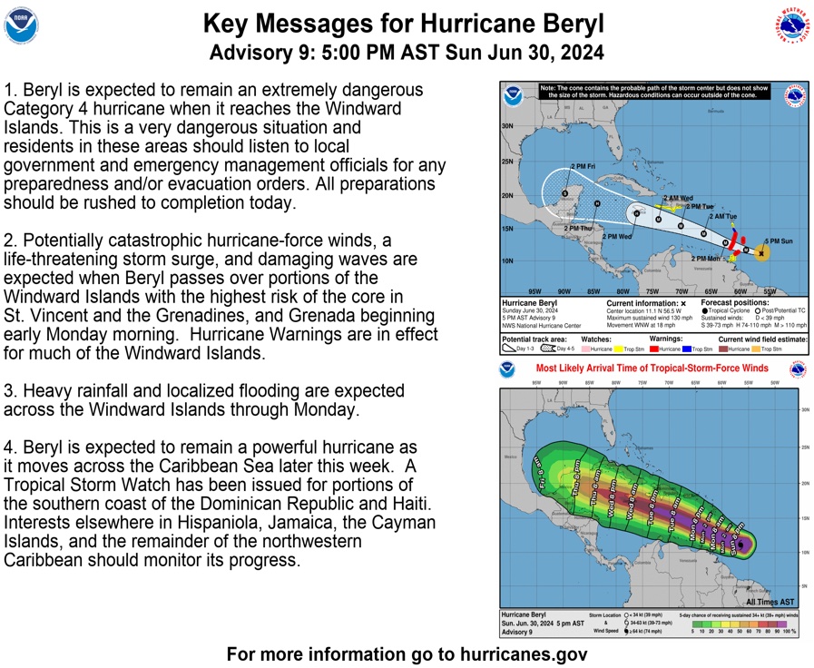
Hurricane season has official begun, with Hurricane Beryl about to create a path of destruction. The long range forecast was for this to be a bad year, we'll see what verifies... either way, a good time to get prepared if you live in an area that is prone to tropical storms!


- Log in to post comments

Top of Page Bottom of Page PermalinkFull Name: Mice elf
Beryl
Beryl
cane
a little dab'll do ya
Top of Page Bottom of Page PermalinkFull Name: Ken D.
Earliest Cat 4 in the
Beryl cane is the name and I served on the west indies line.
Earliest Cat 4 in the Atlantic Basin in recorded history. The southern windward islands are in for some heavy weather. Hopefully, it passes quickly. Jamaica and Mexico are also in its path.
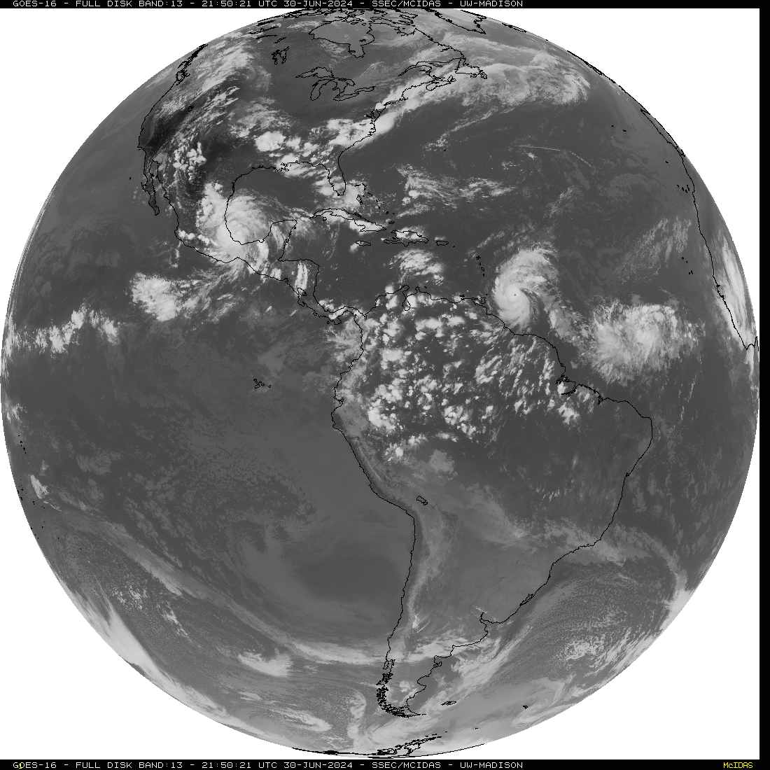
Meanwhile, tropical depression three (soon to be Chris) is forming in the gulf off Mexico and another tropical wave is following Beryl and is likely to become another storm.
Top of Page Bottom of Page PermalinkFull Name: Def. High
Surf's up in Jahmaica, mon!
Surf's up in Jahmaica, mon!
Top of Page Bottom of Page PermalinkFull Name: gypsy tailwind
Thanks noodz
Thanks noodz
Top of Page Bottom of Page PermalinkFull Name: Philzone Refugee
Roll out the Beryl and we'll
Roll out the Beryl and we'll have a Beryl of fun.
Top of Page Bottom of Page PermalinkFull Name: Druba
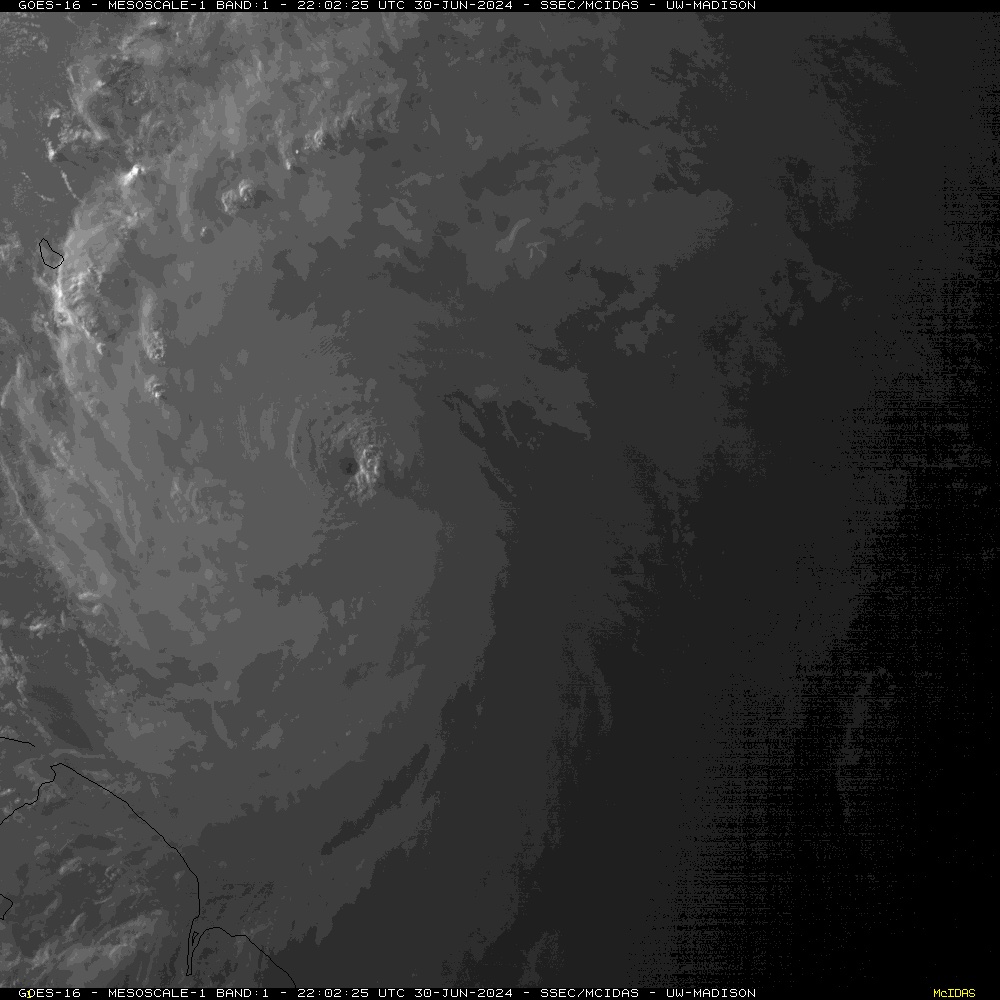
Hurricane Beryl at 4:20 this
Hurricane Beryl at 4:20 this morning (pacific time)
Top of Page Bottom of Page PermalinkFull Name: Druba
Hurricane Beryl Landfall
Hurricane Beryl Landfall Carriacou raw power 4k - Eye wall of category 4
https://www.youtube.com/watch?v=N7ce0TUdiGc
Top of Page Bottom of Page PermalinkFull Name: Def. High
Question for Druba:
Question for Druba:
Why do they still use both the Euro and the GFS models? If they gave the same predictions (they usually don't), pick one and be done with it. If one is better on average than the other, use that one with maybe a few tweaks. If they both have strengths and weaknesses, create a hybrid model.
It just seems like a way for the forecasters to have their cake and eat it too when they give a choice of outcomes depending on which model you want to believe.
Top of Page Bottom of Page PermalinkFull Name: Druba
There's quite a few different
There's quite a few different models out there, we've got several, many countries have their own, etc... they all have different strengths and weaknesses. Then there's the tropical models. One problem, the math behind convection, and tropical weather, is of a different order of magnitude than modelling the jet stream (geostrophic flow)... so they don't play well together, and a lot has changed since I was a student 40 years ago. All models are decent within 48 hours with a few exceptions, beyond 72 hours they can go nuts... but if they're in harmony in the long term then there's a better chance of verifying.
I've noticed the Portland forecast discussion uses a lot more percentages these days based on what the various models say, due to their history of verifying, or not.
Here's a link for PNW forecast discussions / forecasts;
https://www.weather.gov/sew/forecasts
Sorry for the length, but here's todays afternoon weather discussion for Portland; (I left out the marine and aviation part of the discussion). It's amped up the temps quite a bit since this morning
Area Forecast Discussion
National Weather Service Portland OR
400 PM PDT Mon Jul 1 2024 .
SYNOPSIS...Seasonable temperatures will continue through Wednesday as onshore flow continues. A very strong upper level ridge will then begin amplifying and moving into the Pacific Northwest beginning on the 4th of July, peaking in strength July 5-7. Confidence has increased for a significant heatwave during that time as the probability for high temps over 100 degrees has increased dramatically to 60-80% across the interior lowlands. && .
SHORT TERM...Monday night through Wednesday night...The short term forecast is highlighted by an onshore flow pattern with varying degrees of morning cloud cover, afternoon sunshine, and seasonable temperatures. In fact, Tuesday is shaping up to be slightly cooler with high temps generally in the mid to upper 70s across the interior lowlands and 60s at the coast. Wednesday looks to feature similar temperatures, albeit a few degrees warmer. As has been the case over the past several days, northerly to northwesterly surface winds will increase a bit in the afternoon each day, especially across the southern Willamette Valley where winds will likely gust up to 20 mph. This includes the Eugene-Springfield area. Overnight lows each night look to range between 45-55 degrees, warmest over the Portland metro. This will offer excellent overnight relief for those without air conditioning. However, this relief will be short-lived as a significant heatwave is expected to impact the region from July 4-7, and possibly even beyond July 7th. This heatwave is discussed in more detail below. -TK && .
LONG TERM...Thursday through Sunday night...The long term forecast is highlighted by a significant heatwave with record breaking temperatures now likely to occur. HeatRisk is now in the moderate to major category across all of northwest Oregon and southwest Washington, except for the coast where weak onshore flow looks to maintain much cooler temperatures when compared to inland locations. Before getting into the temperature forecast, would first like to discuss the synoptic scale setup in place. Models and their ensembles are now honed in on an upper level ridge amplifying over the western CONUS July 4-7, peaking in strength July 5-7. It appears an omega blocking pattern will develop during that time due to a closed upper level low over the northeast Pacific and another over the Northern Plains into the Great Lakes region. These two lows will help keep the ridge over the western CONUS locked in place for at least three to four days, potentially even longer than that.
With this impressive ridge in place, temperatures will become abnormally hot with record breaking high temperatures now likely to occur. The latest suite of model guidance continues trending warmer, with widespread high temps in the lower 100s for most valley locations away from the coast likely by July 5-6 according to the deterministic NBM. In fact, the probability for high temperatures above 100 degrees has increased dramatically to 60-80%. The warmest ensemble members from the EPS/GEFS suggest high temps close to 110 degrees or warmer, and the NBM is now showing a 15-30% chance for high temps of 110 degrees or warmer. Regardless of whether high temps wind up near 100, 105, or 110, it will be more than hot enough for people to suffer from heat exhaustion or heat stroke if outdoors for a prolonged period of time, or for people who are indoors with no air conditioning. This has helped push HeatRisk into the major category for the entire Portland metro, Salem, Eugene, Columbia River Gorge and Upper Hood River Valley. A major HeatRisk means anyone without effective cooling and/or adequate hydration will be impacted, especially those who are particularly sensitive to heat. Be sure to do everything you can to stay cool during the upcoming heatwave, and don`t forget to check on your neighbors and loved ones from time to time. Lastly, never leave pets or people inside a hot car, and ensure your pets stay cool during this heatwave as well. Walking your dog in the afternoon will not be a good idea as their paws may easily burn. It`s also worth mentioning that overnight lows are looking quite warm with minimal overnight relief. As of right now, overnight lows will likely wind up in mid 60s to lower 70s. -TK && .
**************
Top of Page Bottom of Page PermalinkFull Name: Druba
This page offers some decent
This page offers some decent modeling info in a more user friendly way for those in the PNW
https://weathersigma.com/
https://weathersigma.com/maps
Here's another, currenlty set on the PNW, but lots of info here;
https://www.tropicaltidbits.com/analysis/models/?model=gfs®ion=nwus&p...
Here's a good site for weather records;
https://weather-reporter.com/report?report=25&state&station=0&report_per...
And one for general weather history; (currently set on Porland)
https://weather-reporter.com/station?station=1&fbclid=IwY2xjawDwMkJleHRu...
Top of Page Bottom of Page PermalinkFull Name: Druba
It is extremely concerning to
It is extremely concerning to see a storm of this magnitude start in June, earliest on record as Ken pointed out...
Top of Page Bottom of Page PermalinkFull Name: Druba
Here's the first two
Here's the first two paragraphs of the latest NHC discussion. 140 kts = 161mph sustained winds.
Hurricane Beryl Discussion Number 14
NWS National Hurricane Center Miami FL AL022024
1100 PM AST Mon Jul 01 2024
Data from a NOAA-P3 Hurricane Hunter aircraft tonight has been quite helpful in assessing Beryl's structure and intensity. Within the
past hour, the aircraft measured a peak 700-mb flight-level wind of
157 kt in the northeastern quadrant. A typical 90 percent reduction
translates to a maximum sustained wind of 140 kt, which makes Beryl a potentially catastrophic Category 5 hurricane. This is the
earliest Category 5 hurricane observed in the Atlantic basin on
record, and only the second Category 5 hurricane to occur in July after Hurricane Emily in 2005.
Jamaica is next in line and looks to get hammered.
https://www.nhc.noaa.gov/text/refresh/MIATCDAT2+shtml/020252.shtml
Top of Page Bottom of Page PermalinkFull Name: jazfish
I hnever heard that name
I never heard that name before .
Top of Page Bottom of Page PermalinkFull Name: Def. High
Popular in the US for a girls
Popular in the US for a girls' name in the late 1800s to the mid 1900s, peaking around 1900.
Top of Page Bottom of Page PermalinkFull Name: skyjunk
A guy named Beryl or Burl
A guy named Beryl or Burl taught me the trade I have worked in most of my life. He did time for getting caught driving a semi full of weed, and he eventually died from aids. Great interesting guy, thanks, bud.
Top of Page Bottom of Page PermalinkFull Name: Zzzzzz
Feel for the local
Feel for the local communities on these small islands. Many people living in tough conditions and this won't be easy.
Top of Page Bottom of Page PermalinkFull Name: Druba
8:30pm PT pics (NWS)
10:30pm PT pics (NWS)
and sunset;
Top of Page Bottom of Page PermalinkFull Name: fishcane
I was just in Seadrift for a
I was just in Seadrift for a 260 mile canoe race, just west of this crazy path. Finish line is in the gulf
Top of Page Bottom of Page PermalinkFull Name: intentionally blank
Looking forward to Beryl's
Looking forward to Beryl's depression helping to displace to the east (for a day or two at least) the ridge the west has been baking under.
Top of Page Bottom of Page PermalinkFull Name: jazfish
Eight tornado warnings in my
Eight tornado warnings in my viewing area. Leading band finishing goin through. No warnings headed our way now.
Feeder band coming soon. We're going to be in it a while.
The center of the storm will be passing through about 30- 40 miles west over Marshall, Longview area in East Texas.
I have a Honda and a Predator generators.
Damn sure enjoying the cool spell though. Really enjoying.
This is going to be a wet one but it's really traveling fast.
Top of Page Bottom of Page PermalinkFull Name: Mice elf
https://m.youtube.com/watch?v
https://m.youtube.com/watch?v=CA8oKZHem4Q&pp=ygUgYWxhbiBqYWNrc29uIHRyb3B...
Top of Page Bottom of Page PermalinkFull Name: jazfish
Back later tornado warnings
Back later tornado warnings in our path.
Top of Page Bottom of Page PermalinkFull Name: jazfish
Damn passed just South of us.
Damn passed just South of us.
Top of Page Bottom of Page PermalinkFull Name: jazfish
It's out of here. Lots of
It's out of here. Lots of tornadoes.
Top of Page Bottom of Page PermalinkFull Name: jazfish
A record 59 tornado warnings
A record 59 tornado warnings issued by the National Weather Service in Shreveport, Louisiana today. We live across the river.
Top of Page Bottom of Page PermalinkFull Name: That’s Nancy with the laughin’ face
My BIL is a Red Cross
My BIL is a Red Cross Volunteer who was deployed to Texas. Just saw him being interviewed on the evening news. Hope he doesn't get Covid again. Last two times he was deployed he returned home sick..stop with the hugs :)
Top of Page Bottom of Page PermalinkFull Name: gypsy tailwind
lice used to be the sketch
lice used to be the sketch hug
glad COVID gone
rinse, repeat
no chance of covid in nc
you wouldn't know
because of a mask ban
Top of Page Bottom of Page PermalinkFull Name: dimethyllovebeam
>>>A record 59 tornado
>>>A record 59 tornado warnings issued by the National Weather Service...
Sounds like any other May day in Oklahoma. Glad you're well, Jaz. Just dumped over an inch of rain here in less than a half hour from the outer band of. Beryl.
That ghost will help calm those nerves :)
Top of Page Bottom of Page PermalinkFull Name: Ken D.
For at Cat 1 at landfall in
For at Cat 1 at landfall in the US, seems like it did some serious fucking up of Houston. Million plus homes and businesses still without power in ridiculous heat.
Top of Page Bottom of Page PermalinkFull Name: fishcane
Still packing a punch as it
Still packing a punch as it moved through New York today. Think we got 2 tornadoes here out of it
Top of Page Bottom of Page PermalinkFull Name: Sless is Best
Man, what a trip!
Man, what a trip!
I was in Barbados June 23-29 staying at the Crane Resort
first time visiting there and the food, people, beaches were awesome!
On Friday 40,000 folks poured in for the cricket final between South Africa and India -
India won!
I met an Indian couple from Houston at Crane, there for the match- they had a wedding to attend in CA July 2.... we all went to the beach Friday... was gorgeous blue water and snorkeling over ship wrecks, but by end of the day all the locals were moving their boats and worried about the hurricane. I was one of the last flights out and got back 3am Sunday - when that sucker hit - it ruined so much at Crane- threw palm trees into the pool... and 2 days later a fire started and burned a few buildings where I had been staying near on the property! It sank 2 pleasure boats and threw a bunch of fishing boats into shore- got out just in time!
Nuts!
the couple missed the wedding without flights out, then got pounded in Houston
And so the season starts... insane.
Top of Page Bottom of Page PermalinkFull Name: gypsy tailwind
>> Man, what a trip!
>> Man, what a trip!
I was in Barbados June 23-29 staying at the Crane Resort
first time visiting there and the food, people, beaches were awesome!
On Friday 40,000 folks poured in for the cricket final between South Africa and India <<
awesome, you owned it
as you lead with
>> the couple missed the wedding without flights out, then got pounded in Houston
And so the season starts... insane. <<
thing about texas and their grid
doesn't affect us